All posts by duckie

Cat is a travel addict, tech nerd and former IT teacher. She is a travel blogger who uses her teaching skills to share stories and support others in planning their own adventures. She travels at every given opportunity, with the goal of experiencing a variety of different cultures and engaging in adrenaline pumping activities.

La Paz

OLYMPUS DIGITAL CAMERA
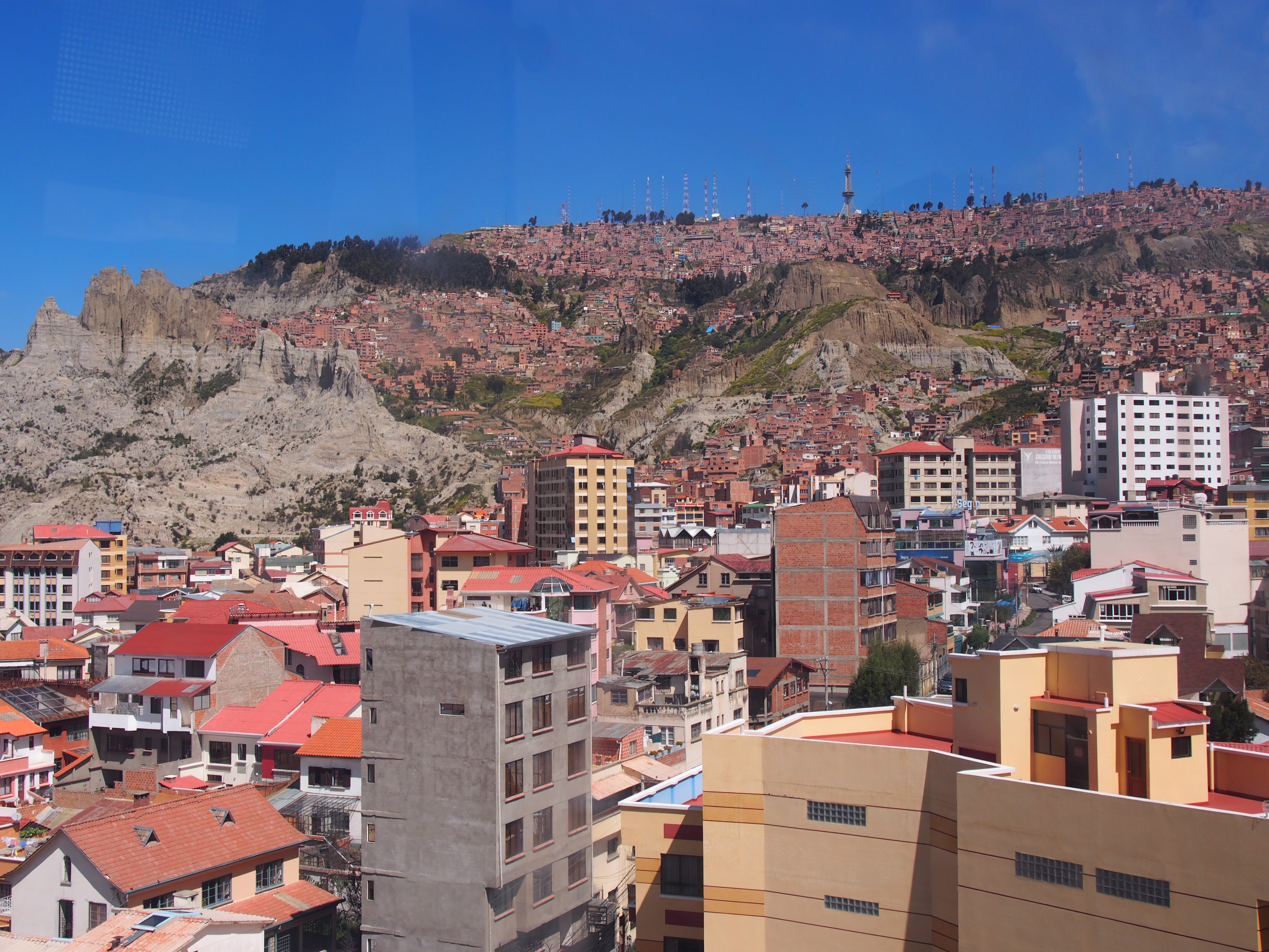
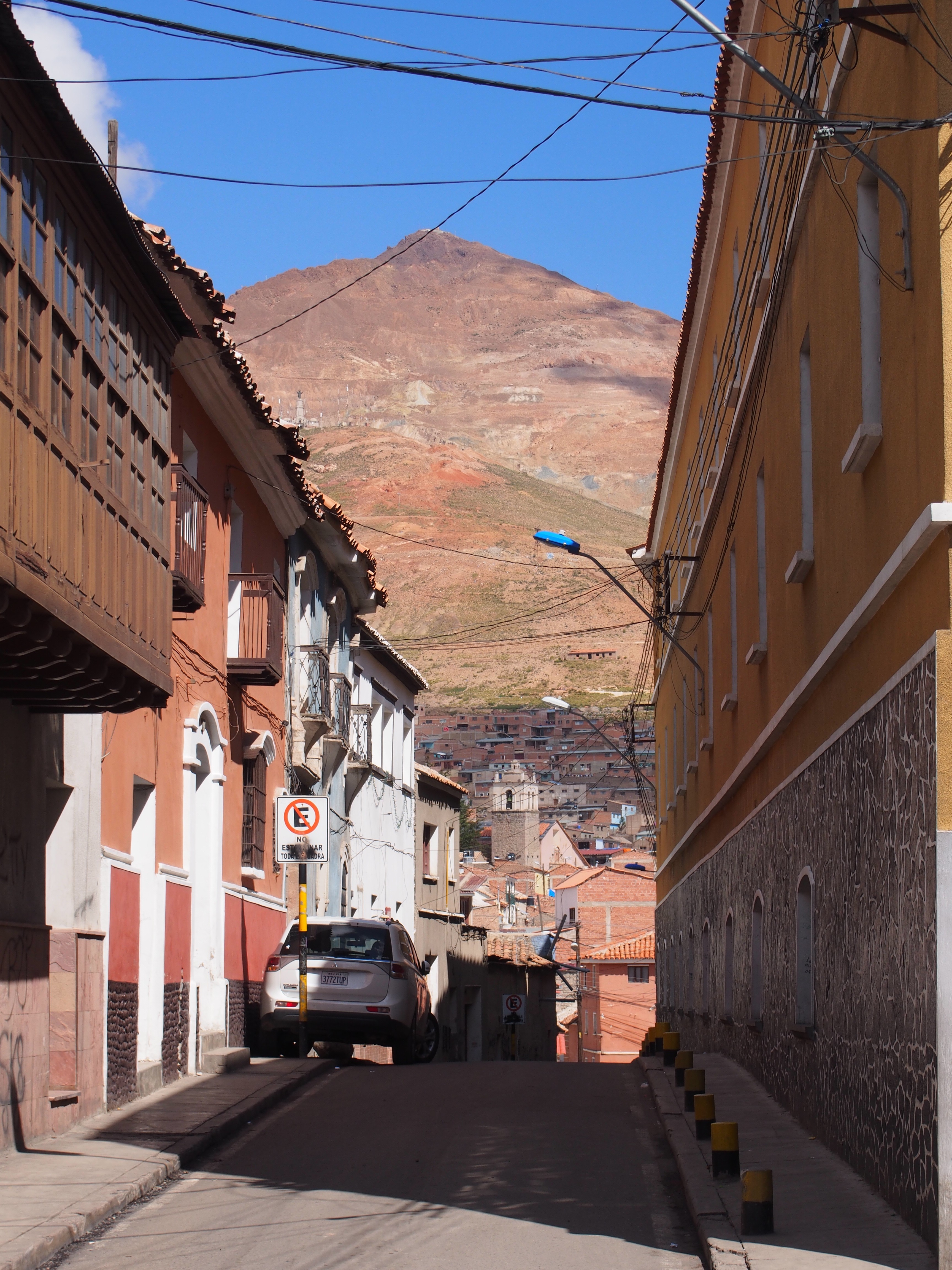
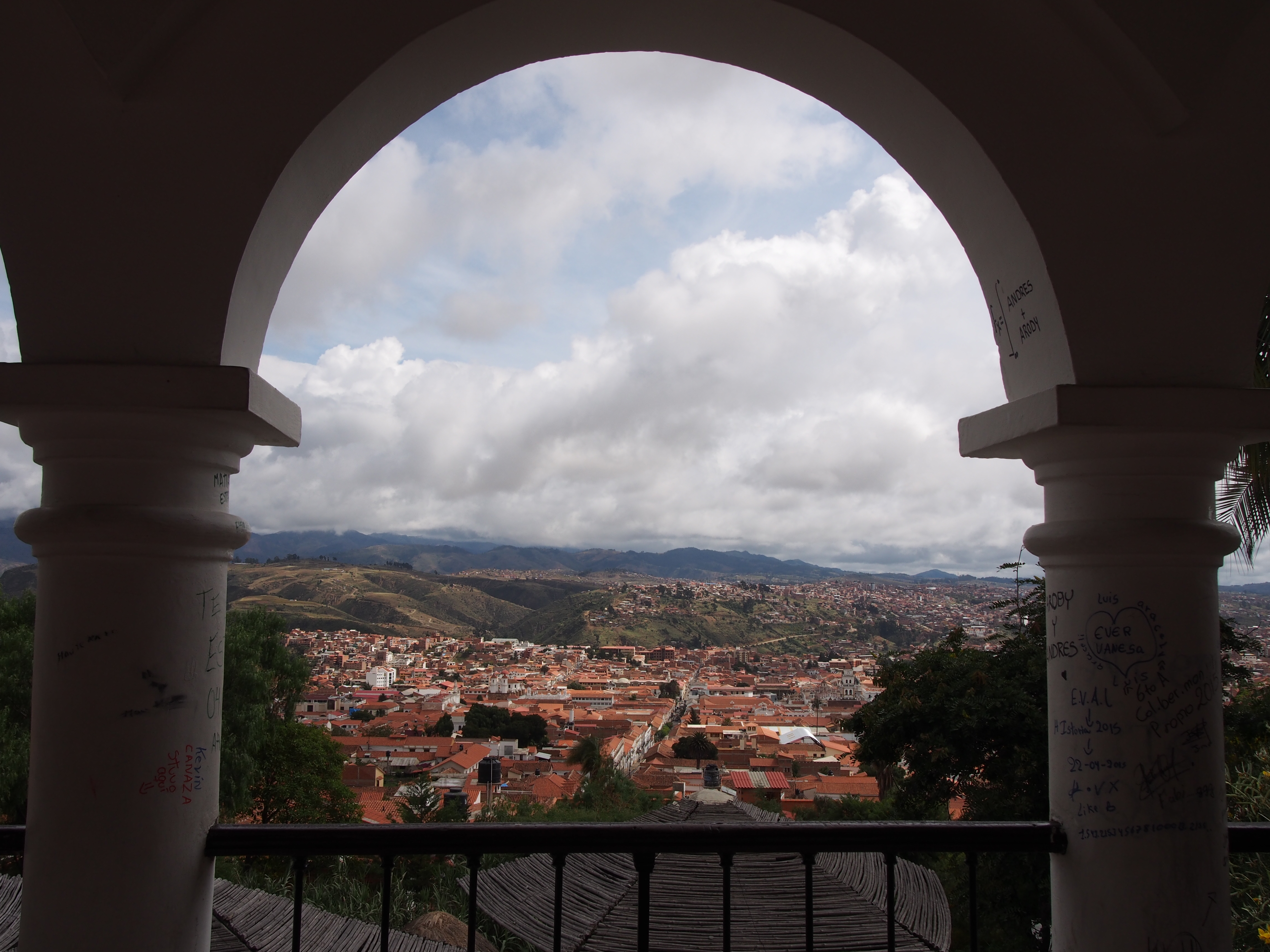
La Paz is an enormous city with a population around 1.4 million. The city, like so many in South America is in a valley. The difference with La Paz is that it is kind of separated into three tiers. El Alto is at the top of the mountain at an altitude of 4100m, central La Paz is in the centre at 3600m and the lowlands are at 3100m. So the city has an altitude difference of 1000m, this also affect temperature, as there is a difference of 1 degree per 100m.

La Paz isn’t particularly well known for its safety, so I didn’t venture too far in my wandering. The hotel we stayed in was across the street from the infamous San Pedro prison, had they still run official prison tours I would have been interested to see inside, particularly after having read Marching Powder by Rusty Young, which details (among other things) the way the prison runs as a community where you need to work for your place in the prison. With no tour I had to settle for a birds eye view from my room.

OLYMPUS DIGITAL CAMERA

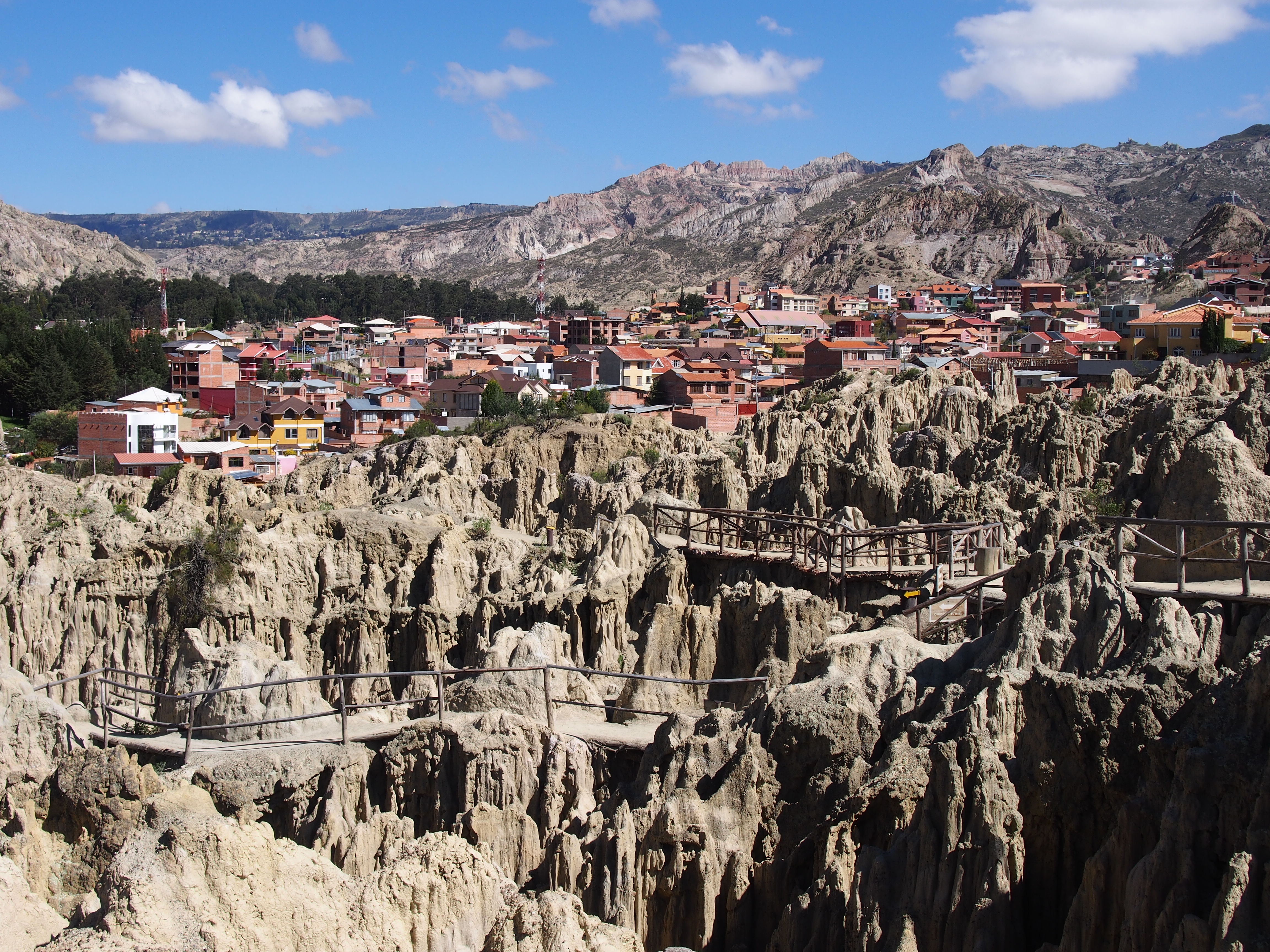
I made a visit out to Valle de la Luna, Moon Valley. It was about a 20mim taxi ride, that cost 35 bolivianos. Entry to the site was 15 bolivianos and I did a self guided walk. The landscape is quite peculiar with spires of land just sticking up out of the ground. It’s almost like a small city of termite mounds. It was interesting to see, but I didn’t need a great deal of time to explore. From the valley, I took a taxi to the green line cable car.OLYMPUS DIGITAL CAMERA

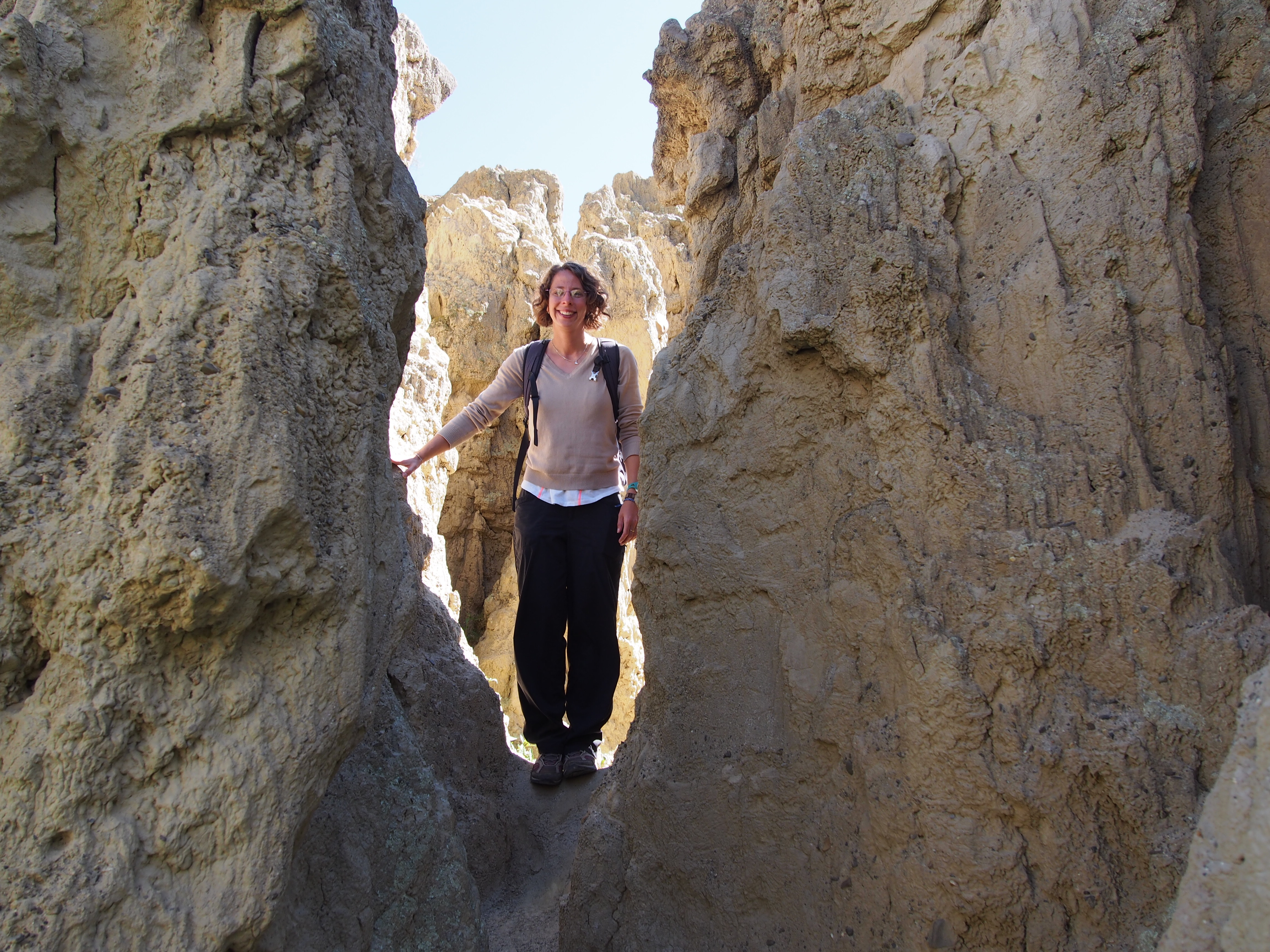
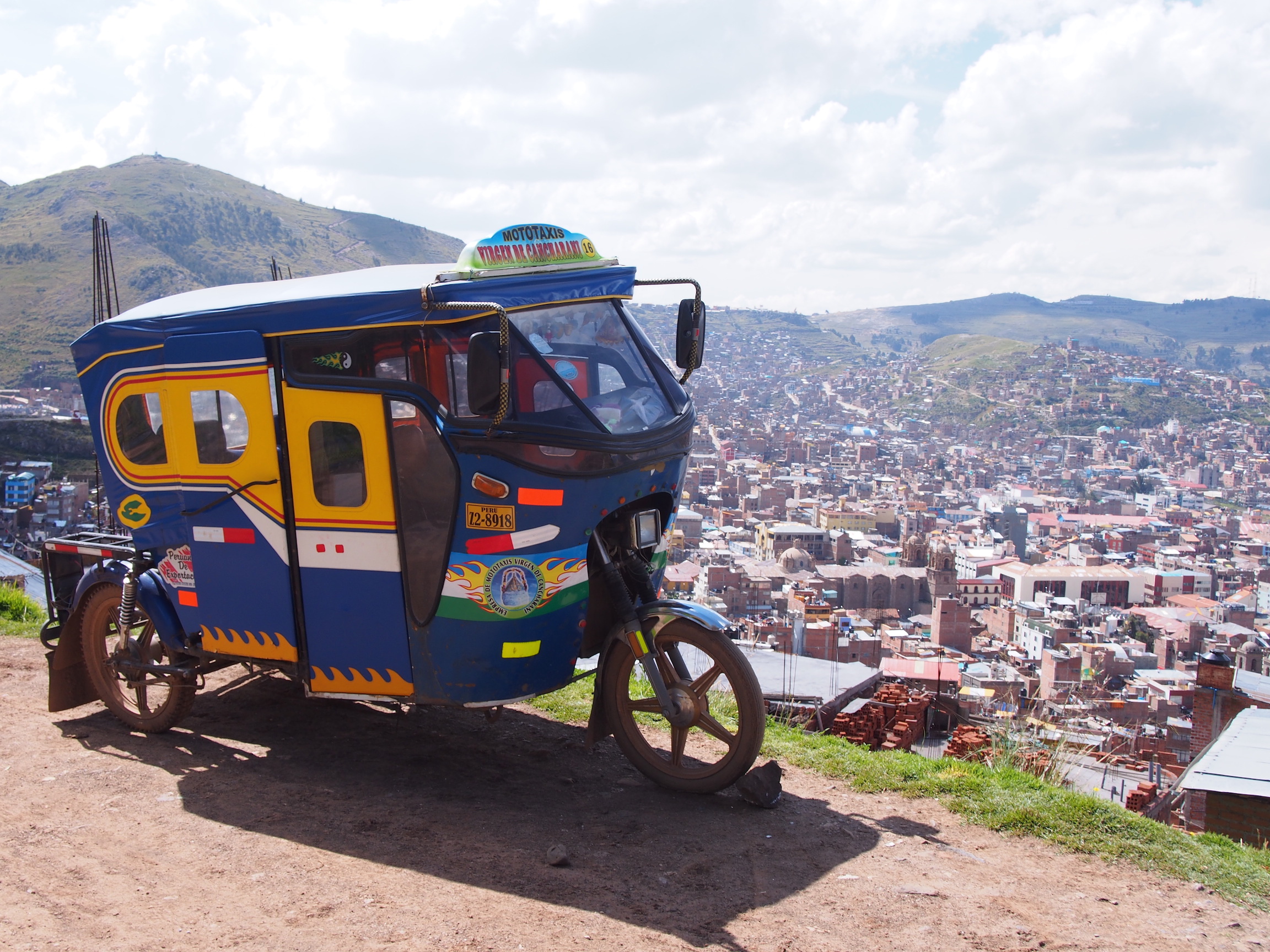
The cable cars are cheap 3 bolivianos per line/colour. They provide the most fantastic overview of the city of La Paz. You are able to see the way people have built into the steep hillside, you can see the affluent areas and normal areas and you can see out over the hilltops to the glaciers!
I took the green line to the end, where I changed to the yellow line and then got off at Sopocachi, which is the closest stop to central La Paz.

OLYMPUS DIGITAL CAMERA
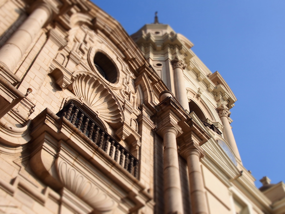
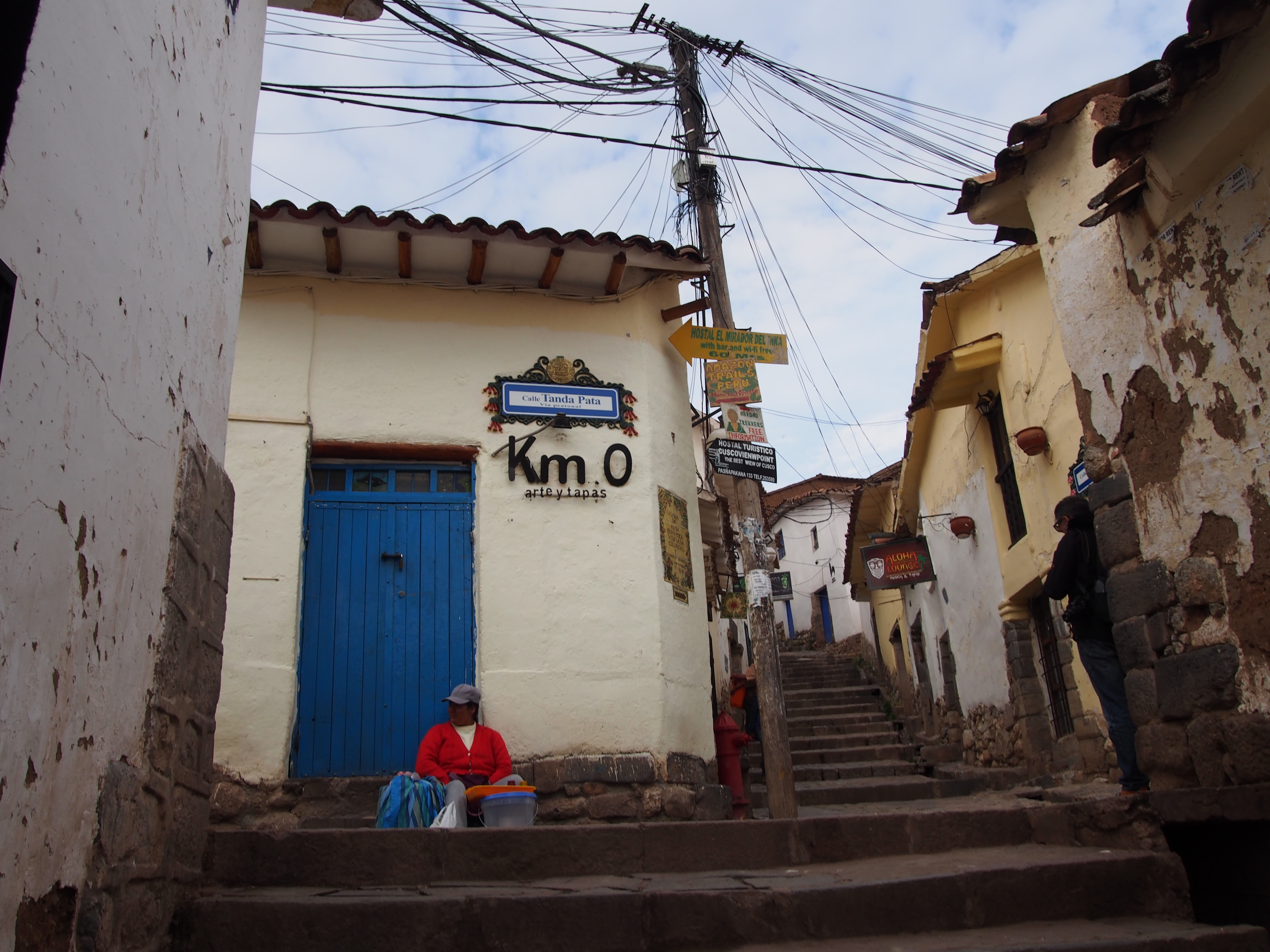
The main street of La Paz is El Prado, but I didn’t spend much time exploring the main street, more the neighbouring streets. The area around San Francisco church is quite good, but it certainly targets the tourists with all the souvenir shops and cafes with the promos of wifi. The street to the left of San Francisco goes up the hill to the witches market where you can find all sorts of talismans and llama foetus’ (I think they are used as sacrifice, I can’t remember).

OLYMPUS DIGITAL CAMERA

The highlight of La Paz for me, which was before I got sick, was mountain biking Death Road.
I went with a company called Altitude Biking as it has good reviews from a few people I knew. Apparently Gravity Assisted Biking is the best company, but they are also twice the price. It was a full day trip and included snacks, lunch, t-shirt and a CD of the photos for USD$108.

OLYMPUS DIGITAL CAMERA

Death Road used to be a main thoroughfare in Bolivia. It’s 3.2metres wide and for the majority of the road, has a 600m drop on one side. Needless to say, as a two way main road it resulted in many deaths over the years. A replacement road was built and opened in 2007, since which time there have been way fewer deaths.

P1570565 (Copiar)
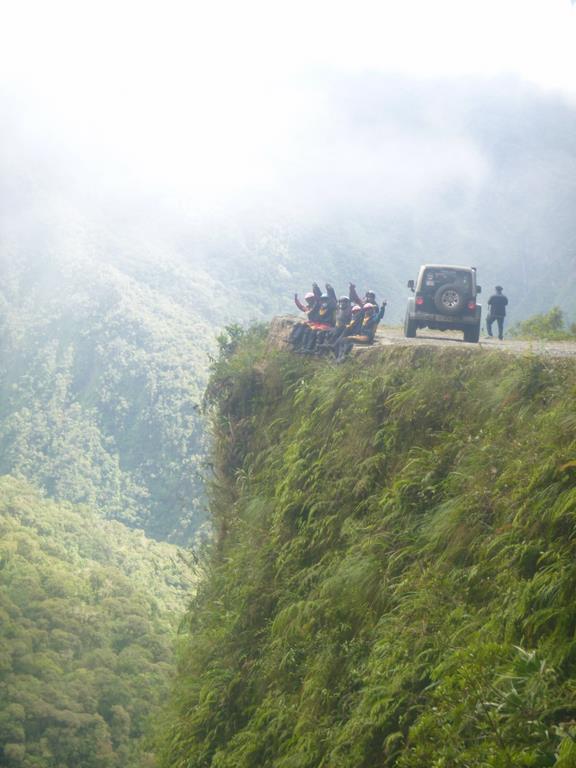
So our ride down Death Road started amongst the glaciers at 4700m. We wound our way down the gravelly hillside through a waterfall or two, stopping for photos along the way, to the sunny jungle at 1200m.
It was terrifying at first, but then loads of fun. The scenery was amazing though we didn’t have too much opportunity to take it in, only during our brief stops. You certainly don’t want to take your eyes off the road for more than a second when you are riding on a cliff edge!!

P1570560 (Copiar)
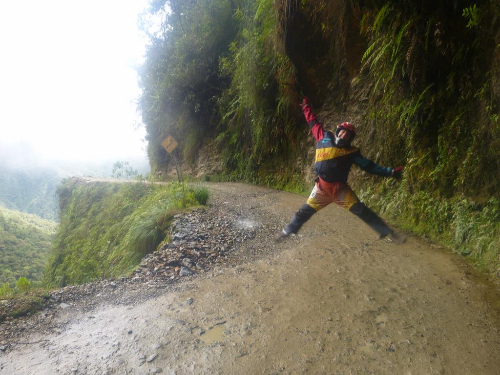
Because we booked the ride with a group of five of us, we were taken as a private tour. I was impressed with the safety standards and attitudes of our guides, Alex and Americo. All bikes were checked and double checked before we headed down the mountain. One guide stayed in from of us at all times, one checked on the entire group as we went and the van followed our group. We were given clear instructions on how to use the road safely and were strongly encouraged to go at our own pace, no matter how slow that might be. Unfortunately a number of the groups that flew past us clearly weren’t advised about appropriate or safe behaviours on the road.
Please note: despite being on an Intrepid Tour, I did the mountain biking on a free day. It is not supported by Intrepid and they actively discourage tour members from doing it.

Thus ended my South American West Coast adventure. I did the Intrepid combo tour Explore Peru and Bolivia and I would highly recommend it!
Brilliantly organised and loads of fun. The tour guides Mario (Peru) and Julia (Bolivia) were just brilliant and their local knowledge made all the experiences so much more meaningful and interesting.

South American East Coast here I come!!!

Check out all my La Paz photos on Flickr.

Facebooktwitterredditpinterest

Potosi & Sucre

Potosi and Sucre are both adorable towns with a very rich history. Unfortunately for me I came down with a nasty chest infection and mild flu basically as soon as I got to Potosi. My illness hung around beyond the visits to both Potosi and Sucre, so I didn’t see as much of these places as I would have liked to.

Potosi

Potosi has its origins in mining and was once the richest city in the world. They say its Cerro Rico, ‘Rich Hill’, was around 80% silver. The city was founded soon after the silver was discovered in 1545. Unfortunately the Spanish took advantage of the readily available wealth and sent the locals to work in the mines in extremely poor conditions. As a result, Potosi has a very sad history.

OLYMPUS DIGITAL CAMERA The town itself, as opposed to the mines, has a strong Spanish influence with colonial architecture and many elaborate cathedrals. The narrow streets are cute, and it’s a joy to wander.

There is a lovely local market, which is well worth a visit.

In the city center is the Casa Nacional de la Moneda, the Royal Mint House. The Spaniards established the first mint in 1572, but by 1575 a newer, bigger mint house was built to cope with the minting machinery.

OLYMPUS DIGITAL CAMERA
A model of the coin press designed by Leonardo Da Vinci

The first coins made were called macuquina, they were fairly shapeless and patterns were printed on them by using a cast and a hammer. Each coin needed to be hit once very hard, to print the pattern on them. Again the Bolivians were used as slave labour and each person was expected to make 1000 coins per day. Over time different technologies were introduced to make them process easier and to make the coins look better.

The visit to the mint house was incredibly interesting, and the guide was very entertaining to listen to as he was so animated, but again the history and abuse of the locals was very sad.

 Sucre

OLYMPUS DIGITAL CAMERAWhile La Paz seems to be the city most people know about in Bolivia, Sucre is actually the country’s capital. The buildings here are gorgeous, whitewashed and are a fantastic display of colonial architecture. The city was declared a Unesco World Heritage Site in 1991. It’s another city that is just fabulous to wander around and get lost in.

OLYMPUS DIGITAL CAMERAThe local market is fabulous and has a huge array of fresh fruits and vegetables, meats, bread and many other things. Around the city are loads of small plazas.

OLYMPUS DIGITAL CAMERA It’s well worth the walk (or in my case taxi ride) up the hill to Recoleta, the view of the city is just amazing and it’s such a relaxed place to sit and have a coffee and soak up the atmosphere. There are some shops for souvenirs as well as café’s. From Recoleta it’s a nice stroll down hill back into the city center.

OLYMPUS DIGITAL CAMERA

On the outskirts of town in Cal Orck’O, about a 15 minute drive is a cretaceous park. Many years ago when they were mining the area they discovered fossilized dinosaur footprints. Due to tectonic plate movement, the footprints aren’t on the ground, but are on a vertical limestone wall. There are over 10,000 tracks of at least 8 different dinosaur species that have been found, and they are still discovering more. I found it quite fascinating to see the footprints, but I found most of them weren’t obviously discernable as dinosaur prints, but then I’m not a dinosaur expert. I found the visit a little bit disappointing, but I still think it was worth the effort and I am glad I went.

OLYMPUS DIGITAL CAMERA

Other than my short distance wandering and my two major outings, I wasn’t well enough to see more of Potosi and Sucre, but I am sure they both have loads more to offer!

For all my pictures, check out my Flickr album.

Facebooktwitterredditpinterest

The Southern Altiplano

The Southern Altiplano is the region south of La Paz, it has quite a harsh geography with deserts, mountains, volcanoes, glaciers, rock formations appearing out of nowhere and the seemingly endless salt flats.

Uyuni

Uyuni is the gateway to popular area of the Southern Altiplano, the salt flats. Uyuni is about a 10 hour drive from La Paz, we did it as a combination of bus and then jeeps. It’s quite a dinky little one horse town, but has it’s own charm.

From Uyuni most people head out on a three or four day jeep trip around the highlights of the area. Our tour group did a three day tour.  While there are many awesome things to see and it’s definitely well worth the time and money, be aware that these trips are predominantly driving.

Cemetario de Trenes

The first stop is the train cemetery. The trains were used by mining companies but when the industry collapsed, the trains were abandoned.
I thought it sounded uninteresting when I heard we were headed there, but once I got there, I actually found it really interesting. There were so many trains and many of them had cool graffiti on them. It was kind of like an adult playground.

Colchani

The second stop was a brief visit to a town called Colchani. This is where the salt from the salt flats is processed and packaged. On our very brief visit the processes were explained to us and the packing was demonstrated.

Salar de Uyuni 

This was absolutely 100% the highlight of the trip for me. The salt flats stretch for kilometres and kilometres (12,106 square kilometres) at an altitude of 3653metres. While all these kilometres of salt flats are basically all the same, I never tired of looking at them. The parts that are under water provide awesome reflections and the dry parts have really cool polygon patterns in them. It was also crazy to realise that in some places the crispy layer of salt was only about 10 cm thick, and if you broke the crust there were a few metres of water below.

Because of the extensive salt flats, all looking the same, you can create really awesome pictures using perspective. I had an absolute blast taking quirky pictures.

Island Inkawasi

In the middle of the salt flats, randomly popping up out of nowhere is an island, Island Inkawasi. It is covered in really old cacti and was really awesome to see. We did a short hike to the top of the island and had a fantastic view over the salt flats.

“Marith En”

We finished the first day of the jeep tour in a salt hotel called “Marith En” in a town called Atulcha. I was so excited to stay in a salt hotel, such a novelty!!

In reality they look quite dirty and are cold. But hey, I stayed in a salt hotel!!

Lakes, Volcano’s and Desert

The second day of the tour had many short stops.

We saw the smoking volcano Ollagüe. It’s an active Volcano that is partly in Bolivia and partly in Chile. It last erupted 100 years ago.

There were four lakes: Laguna Cañapa and Laguna Hedionda, which are both known for their flamingos. We drove past, but didn’t stop at Laguna chiarkhota, The last lake was Laguna Honda, known as the romatic lake, as it is in the shape of a heart (Though I feel that required some imagination to see).

We drove through the dusty dry Siloli Desert and saw a fox and a viscacha (a Bolivian bunny type creature with a long tail). We made a brief stop at the mountain of seven colours, our altitude at this point was 4741m.

We made another stop at some geological rock formations, the most famous of which was the Arbol De Piedra, tree stone. A rock that has been carved into a tree shape by the wind over many years.

We visit one last lake, Laguna Colorada, which is bright red from all the microorganisms living in the water. It was quite cool to see.

We spent the night in dormitory accommodation in a tiny town called Huallajara. Our altitude here was 4230m and it was cold!!!

Mud Bubbles, Hot Springs and more Desert

We started the morning well before sunrise and headed to Sol de Mañana (Morning Sun) to view the sunrise as well as the mud bubbling sulphur pools. This was the highest point in the journey at 4912m and it was freezing cold!

The mud bubbles were eerie to watch, they stank, but they were quite spectacular to see. Even more spectacular was the sun rise which could be seen through the steam clouds.

After the mud bubbling pools we headed to the hot springs at Polques where we had some breakfast and then some people hopped into the 39 degree hot springs for a soak. While the hot springs sounded appealing, the idea of getting out and having to dry off in temperatures around 9 degrees was not appealing, so I settled for soaking my toes in the warm water.

The next stop was a stretch of desert called Salvador Dali Valley. It was thought that the artist Salvador Dali visited this desert and it inspired many of his artworks, most notably his melting clock.

We then made a quick visit to Green Lake. Though it’s no longer green. An earthquake in Chile in 2014 somehow caused the copper (the source of the green colour) to dissipate.

The last stop before arriving back in Uyuni was Valle Ve Las Rocas, another geological fault which caused rock formations to pop up out of nowhere in the desert. They were pretty cool to look at too.

Sneezing 

Driving through the desert unsurprisingly results in dust, which causes you to cough and to sneeze. Something I learned about sneezing in South America is that they don’t say bless you, that’s not the surprising part.

If you sneeze consecutive times, they say something different each time.
The first sneeze they say Salud, which means health.
The second sneeze, they say Dinero, which means money.
The third sneeze is Amor, meaning love.
So if you sneeze three times consecutively you are wished health, money and love.
I thought that was pretty cool.

For all my pictures, check out my Flickr album.

Facebooktwitterredditpinterest

Lake Titicaca

OLYMPUS DIGITAL CAMERA

Lake Titicaca is considered the world largest navigable, high-altitude lake at 3,808m. The lake is 165km long, 60km wide and they think around 300m deep. The lake is massive and approximately sixty percent of it is in Peru, the remaining forty percent is in Bolivia.

Puno

OLYMPUS DIGITAL CAMERAPuno is a large city on the edge of the lake, that seems to operate as an access point to the islands on the lake. The centre of Puno has many old but gorgeous colonial buildings. A little further out of town are bumpy dirt roads and mud brick houses. The main street of Puno has many cute shops and restaurants, some nice old cathedrals and set back behind a school is a local market.

OLYMPUS DIGITAL CAMERAUp on the hill overlooking the city is a rather ugly statue of a condor, one of the most important animals in the Peruvian culture. Despite the ugly statue it provides an amazing view of the entire city of Puno and the lake.

Taquile Island

OLYMPUS DIGITAL CAMERATaquile Island is a UNESCO protected island that maintains much of the original culture. The island has a population of 2500 people. They are known for knitting, weaving and farming. The men on the island are some of the best knitters in the world.

The island is gorgeous and provides a brilliant insight into the lives of the people. One of the things I found fascinating was the traditional clothing that is very colourful and steeped in tradition.

OLYMPUS DIGITAL CAMERAThe men wear black pants, a white shirt with a short black waist coat and a decorative knitted belt. The single men wear a hat/beanie that’s predominantly white, with some colour at the top. but married men have a beanie that’s colourful all over.

The women wear layers of brightly coloured skirts, bright tops and wear a black shawl with brightly coloured pom poms hanging off it. Single women display four pom poms, and the pom poms are very big. Married women have pom poms that are smaller, and they only display three.

OLYMPUS DIGITAL CAMERAThe other thing I found fascinating is that when men greet each other, they don’t shake hands, they give each other some coca leaves from their bag.

Llachon

OLYMPUS DIGITAL CAMERA
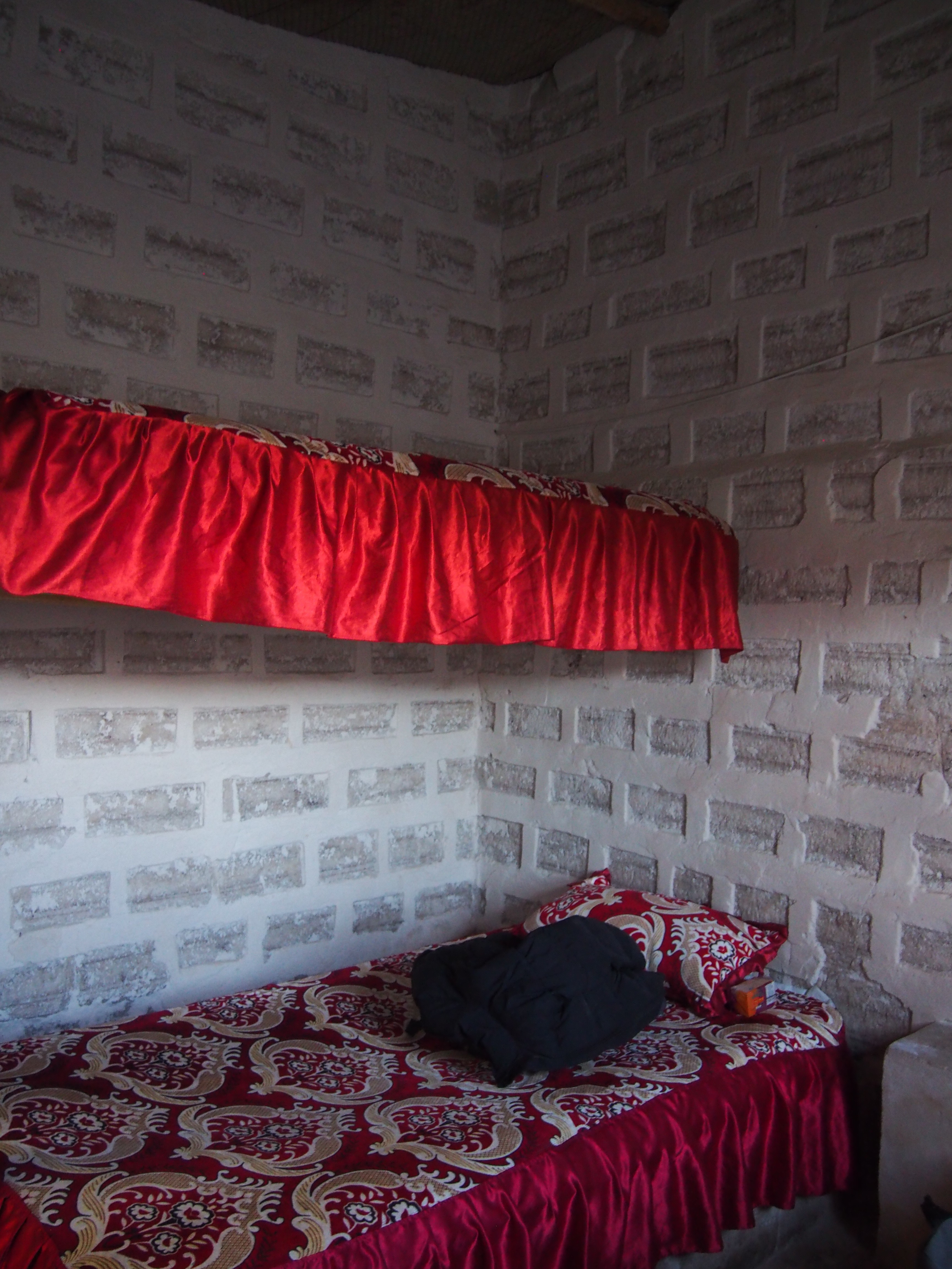
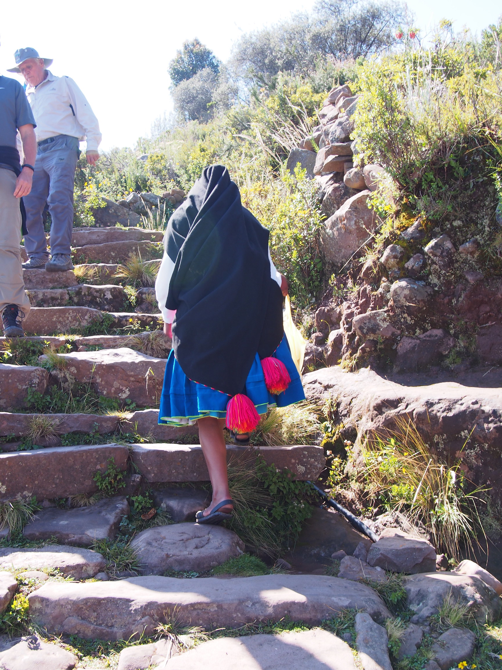
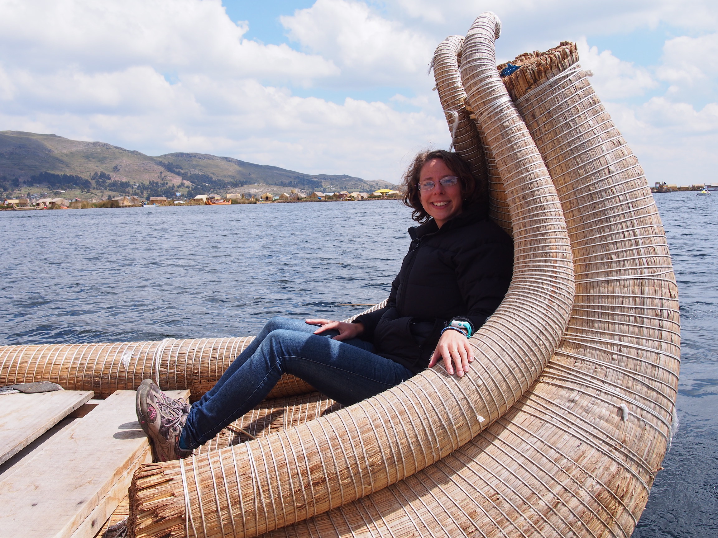
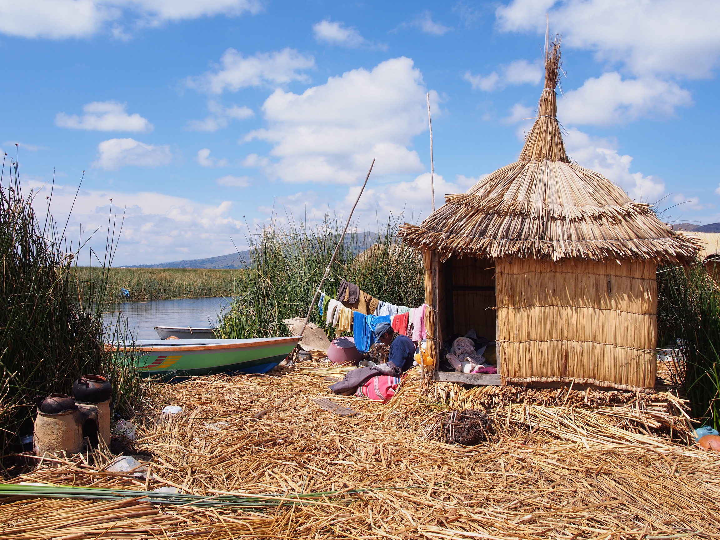
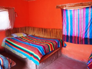
Lllachon is on a peninsula and this was where we had a homestay with a local community. We were each allocated to a family; I was together with three others from the group. Our homestay mum was Pastora. She had a gorgeous little son named Sebastian. We were given private little mud brick huts to sleep in. The beds were also made of mud brick, covered with a layer of reeds, then the mattress and bedding.
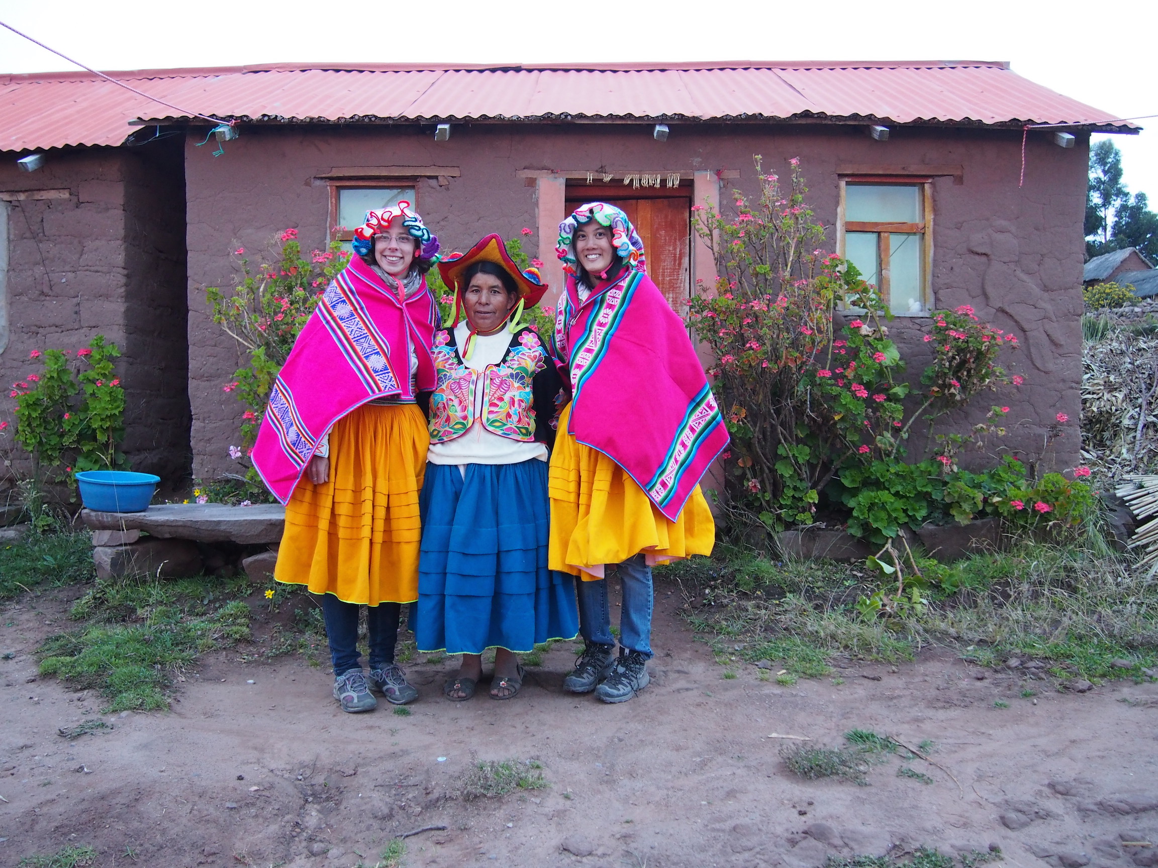
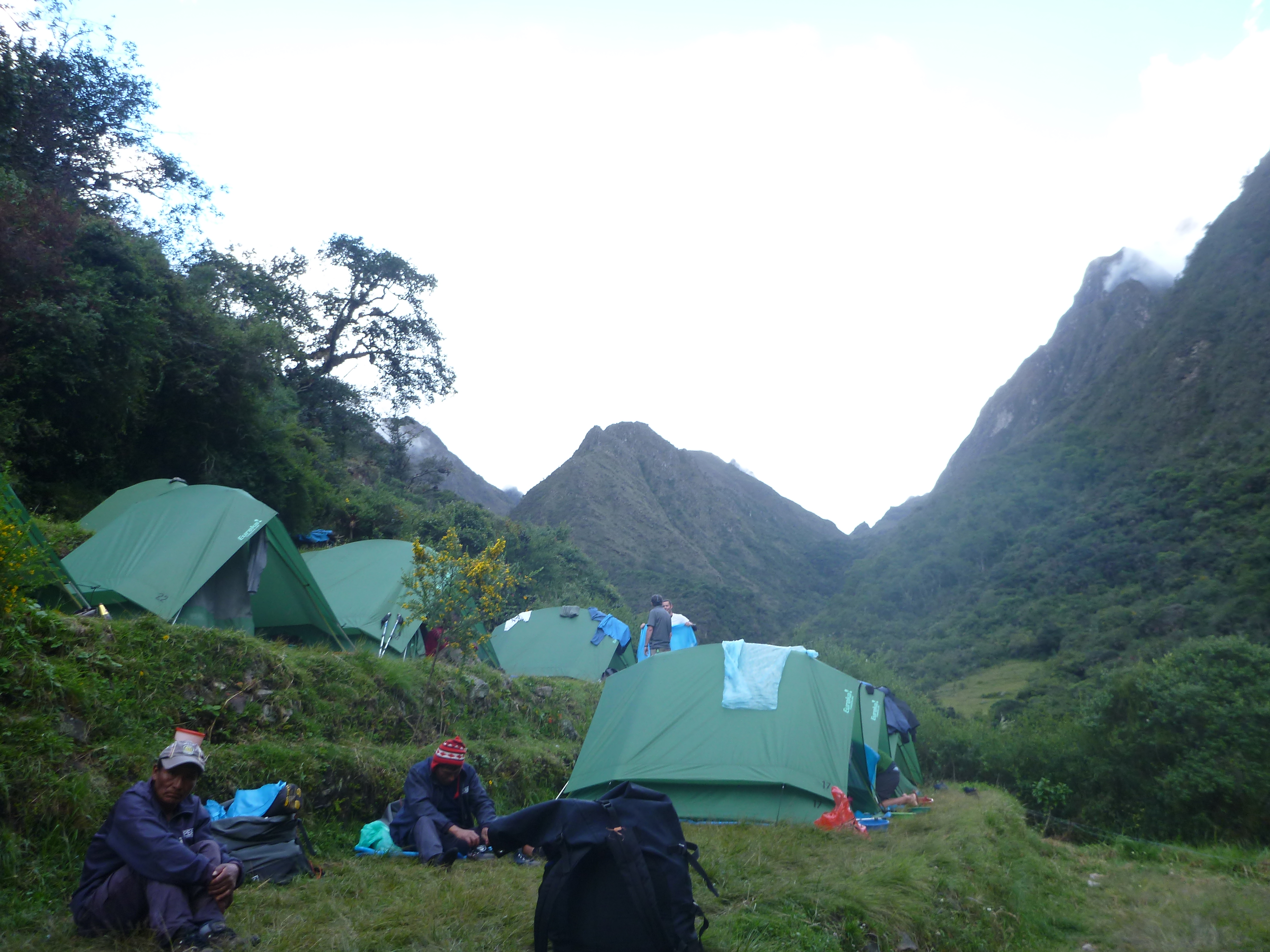
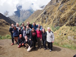
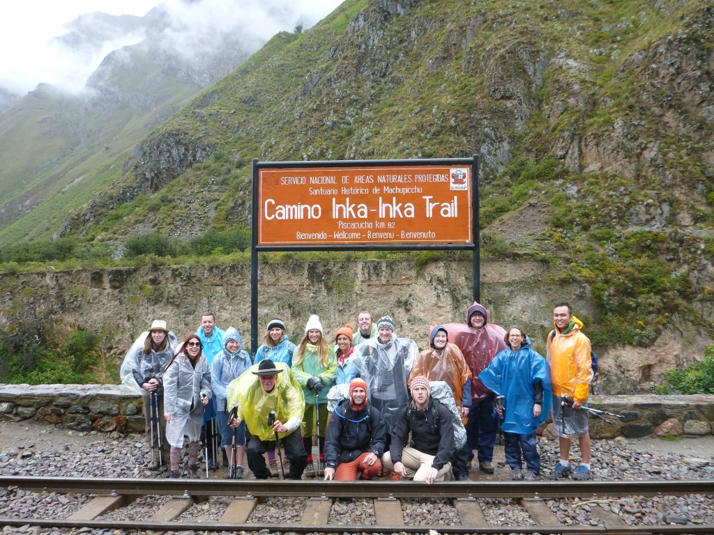
OLYMPUS DIGITAL CAMERAWe helped our homestay mum to till the fields and harvest potatoes. We then gathered with the rest of the community to play some volleyball (or in my case, take pictures). After the fun, we all were dressed in traditional clothing.

The traditional dress in Llachon differs from that of Tequile Island, but still shows the distinction between single and married people.

OLYMPUS DIGITAL CAMERAThe single men wear brightly coloured poncho’s and beanies, while the married men wear more muted colours. The women wear brightly coloured skirts, a white embroidered shirt, knitted belt, coloured shawl and a beanie that is long and colourful, but has a white frilly edge around the face.
Married women have a black embroidered jacket over their shirt, rather than a shawl, and wear a black hat with two pom poms.

OLYMPUS DIGITAL CAMERAOn both islands, the mean make the hats. jackets, belts and so on for their wives, as a sign of love. Similarly, the women make the beanies, belts and bags for their husbands. A man who goes to a party wearing many bags (thirty or more) is a very proud man, as he has so much of his wife’s love on display.

Once we were in our traditional dress, we all headed to the kitchen where we chopped up vegetables for the evening meal. Our families cooked for us and we ate a delicious meal of all home grown and freshly harvested vegetables.

The next morning we had another freshly cooked meal, before saying our goodbyes.

Uros Islands

OLYMPUS DIGITAL CAMERAThe Uros Islands are floating islands made of reeds. They are clustered in roughly the same area and are made up of around 50 islands. The islands are built with layers of buoyant reeds called Totora reeds. As the reeds rot, the islands are built up with more layers of reeds on top.

OLYMPUS DIGITAL CAMERAWe spent a very short time on the Uros Islands, but were shown how the Islands are constructed and we were shown the simple lifestyle of the inhabitants. The Islands have become quite commercial, but are still interesting to visit.

OLYMPUS DIGITAL CAMERA


For all my Lake Titicaca photos, check out my album on Flickr.

Facebooktwitterredditpinterest

The Inca Trail to Macchu Picchu

The Inca Trail starts in Ollantaytambo, where you receive a small duffle bag and your rented equipment (in my case a sleeping bag US$20 and walking poles US$15). Anything that fits into the duffle is for the porters to carry and cannot weigh more than 6kg. You really do need to pack for all kinds of weather!

The porters each carry packs of 25kg or more, including the duffle bags, tents, tables, chairs, toilets, gas bottle, the kitchen, food and more. We had a group of fifteen people, supported by three guides, Ruli, Elvis and Monica, and twenty-four porters.

P1050390Day 1

On the first day we caught a bus to “KM 82” of the Inca Trail. This is a place known to the locals as Piscaqucho, which means five corners. The starting elevation at this point was 3,375 metres.

The very start of the Inca Trail has a check-in point where you provide your passport; it is cross-checked against your Inca Trail permit and then you receive a stamp.

P1050448Due to the rain we had layers of rain coats and ponchos. As we stepped onto the bridge to cross the Urubamba River and start the Inca Trail though, the rain simply didn’t matter.

The walk was up and down hills, and we saw many beautiful mountains and some Incan sites along the way. By 1pm, we were all hungry. We met the porters at Hatunchaca for lunch. There they had set up a kitchen tent, dining tent and toilet tents. We had a delicious three course meal for lunch, followed by cups of tea and then we were on our way again.

P1050438The trail ended on an incline and spirits were high as we walked into our Wayllabamba (3,000 metres) campsite around 4:30pm. Once we were allocated tents and given the lay of the land, it was afternoon tea time. Hot chocolate, pop-corn and cookies!

We remained seated and chatting, a three-course dinner was served and then we were all so tired, it was time for bed.

Day 2

P1050483Due to landslides at the normal campsite for day 2, our campsite was set for some distance further along the trail, which meant that we had to walk further than normal on Day 2 and that our hike would actually finish on Day 3 instead of Day 4 (which we excitedly learned meant we would see Macchu Picchu twice). This meant an early start, with our wake-up call and Coca Tea at 4:45am.

Very dopey, we all packed our bags, had our breakfast, layered up in raincoats once more and put our packs on, to start making our way up to the highest point of the trail, Dead Woman’s Pass.

OLYMPUS DIGITAL CAMERAWith the altitude and the sharp incline, it was quite slow going. Maintaining a slow and steady pace, we reached Dead Woman’s Pass, an elevation of 4,215 metres. The rain cleared just as we reached the peak. This was such an incredible achievement – we were all really excited to have made it, and celebrated with a snack and an amazing view.

OLYMPUS DIGITAL CAMERA

At each stopping point our guide told us something about the environment or the culture, which made the journey a rich experience. One of the things Ruli would regularly say after explaining something or telling us what we were going to do next was “Clarito de Luna?” — Clear as the moon? — in order to check if we understood. It became a cherished saying along our hike.

OLYMPUS DIGITAL CAMERA
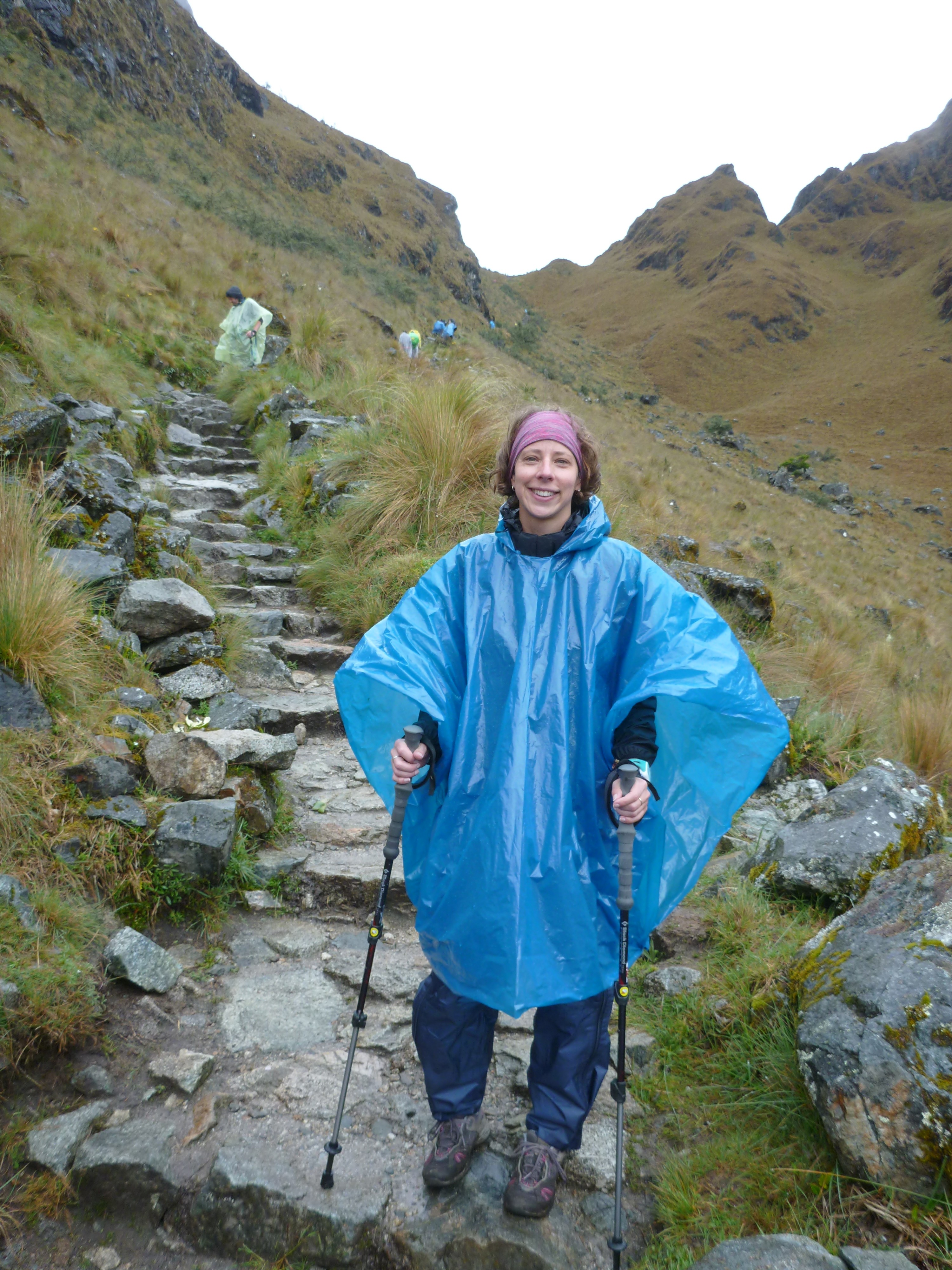
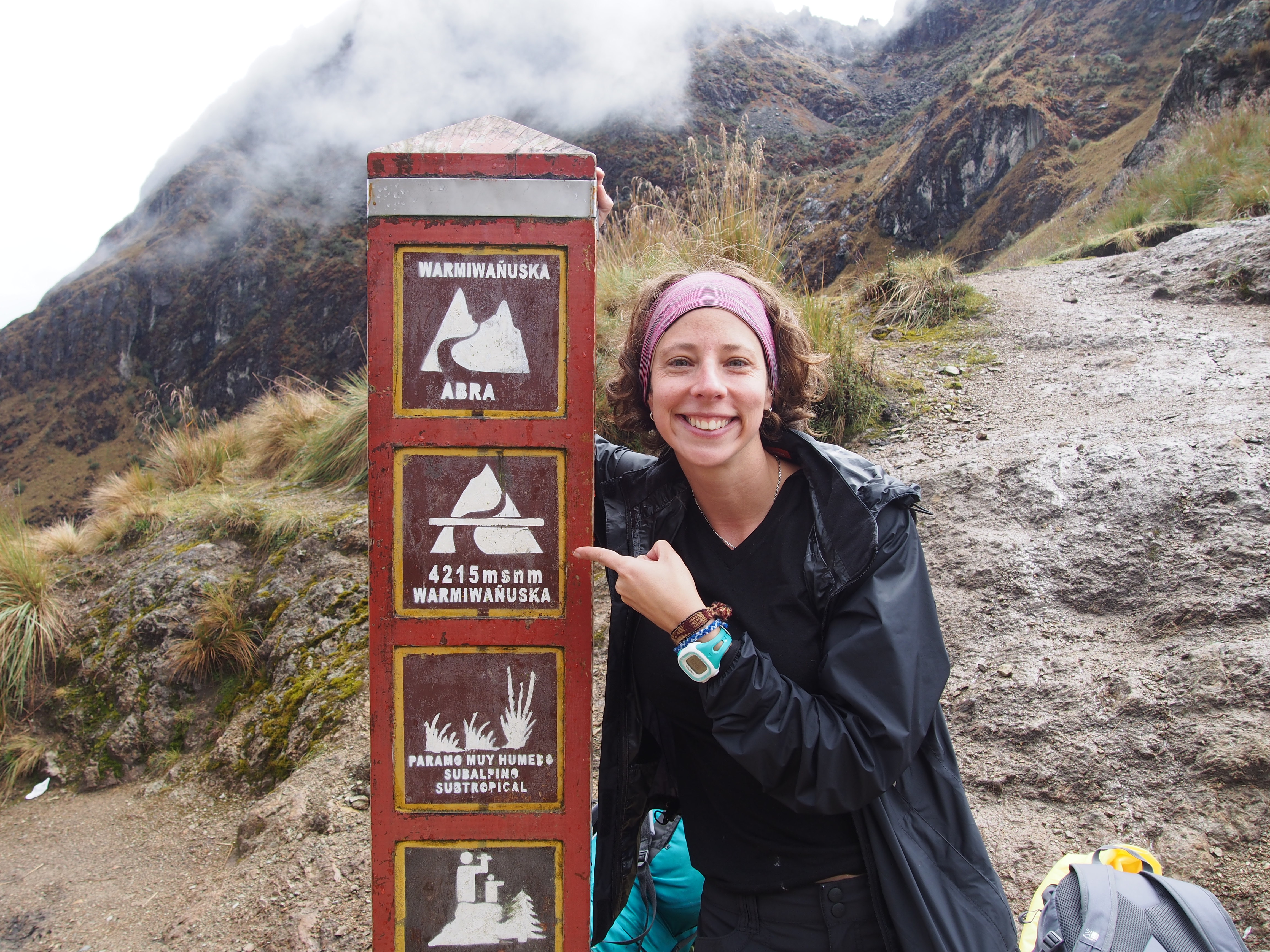
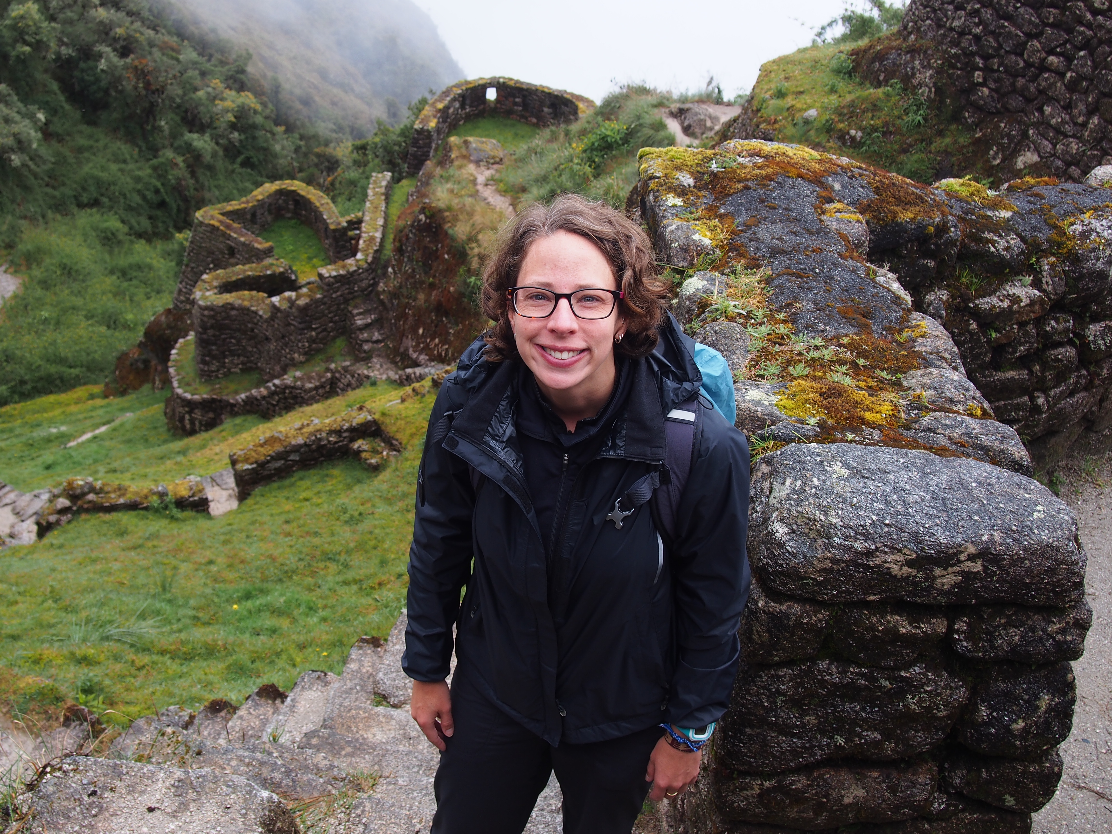
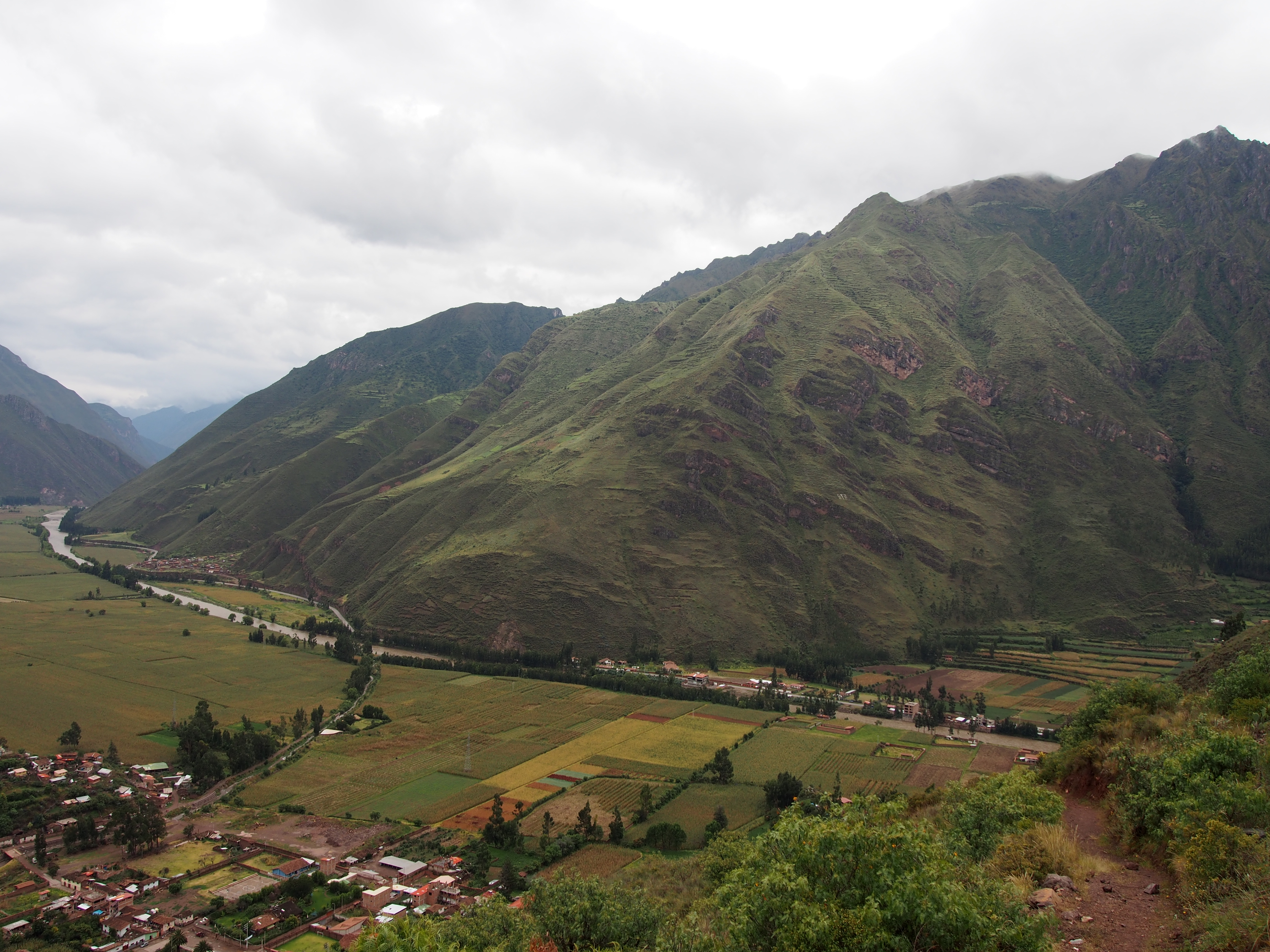
With such a big day ahead, it was soon time to carry on. We crossed the top of the pass before heading down a steep decline on the other side. We continued down and down to 3,600 metres where we were able to stop for lunch at Pacamayu. This is the normal camp site for Day 2.

After quickly recharging our bodies with food, we were off again, headed up to the Incan ruins and then the second pass, both of the name Runcuraqay. The pass was 3,800 metres and a much steeper incline than Dead Woman’s Pass.

P1050572The rain came back and it was time for ponchos once more. Through the rain and mist we had a quick look at another Inca site, Sayacmarqa, high on a hillside at 2,650 metres before continuing onto to our campsite for the night at Chaquicocha (I think the elevation was around 3,200 metres – slightly higher than the first night). After a full day of rain, a swampy campsite and roughly eleven hours of hiking we weren’t the most excitable group of hikers at that point in time. The cooks certainly raised spirits with another amazing three-course meal, and this time the main dish was Spaghetti Bolognese. The dinner tent was silent as everyone tucked into the amazing meal!

Day 3

The third day started off dry and despite a few moments of drizzle was predominantly a perfect day in terms of the weather. It was to be another long day, but slightly less physically challenging than day two.

OLYMPUS DIGITAL CAMERAAs we were nearing Macchu Picchu, there were more Incan sites along the way. We stopped at Phuyupatamarca (3,640 metres), Intipata and the had lunch at Wiyñawayna (3,640 metres). They are all such amazing sites to see and each one is different.

OLYMPUS DIGITAL CAMERA

We learned a great deal about Incan/Andean beliefs and one of them stuck with me. It’s the Andean Cross (Southern Cross) symbol. It is known as Chakana, and is split into two halves which each have six steps. Each set of steps is a group of beliefs. The Andeans have a strong connection to the earth and a strong sense of community. One set of steps is about reciprocity. If you help someone, some time later they will help you. This may be on a one to one basis, or a community helping a neighbouring community or on a more global scale. But maintaining the idea that if you do something positive for someone, you will have it returned. I really like that philosophy. I guess we sometimes refer to this as karma, though I’m not sure if it’s really the same thing.

P1050529After lunch we were told it was just two hours to the Sun Gate (Intipunqu), where we would catch our first glimpse of Macchu Picchu. So we put on our packs and with a spring in our steps continued along the undulating Inca Path amongst the rainforest.

When I stepped through the sun gate, I was just breathless. A lifetime goal was achieved and I stood looking at one of the most amazing sites I had ever seen. In the distance was Macchu Picchu (at 2,450 metres), the lost city of the Inca’s. Bathed in sunlight, set against a blue sky it simply glowed.

OLYMPUS DIGITAL CAMERA

OLYMPUS DIGITAL CAMERAAfter about twenty minutes of staring at such a wonderful site, we quickly had to descend into this wonderful city before they closed for the day. We arrived exactly on closing time and had to beg the guards to allow us to take ‘just one picture’ before we had to leave. We were so blessed to be able to enter this magical city when there were no other visitors. Despite our rush to take a picture (or ten) it was such a calm place to be. We were all very quiet, taking it all in.

OLYMPUS DIGITAL CAMERAOnce the guard starting to get cranky, we all headed out of the site, had our passports stamped and hopped on the bus to Macchu Picchu town, officially known as Aguas Calientes (2,050 metres).

Another unfortunate (or fortunate in some ways) circumstance around the ‘new’ last campsite was that due to all the rain, it was flooded. Though none of us would have chosen to stay in a hostel, we were all quite relieved when that decision was made for us. Every single one of us thrilled at the idea of being warm and dry.

We celebrated our hiking success and luck with the weather with a beer and meal together, before crashing in our dry, warm beds.

Day 4

OLYMPUS DIGITAL CAMERAThe final day we caught the bus back up to Macchu Picchu, where it was rainy once more. Our tour guides gave us a tour of the city, and thankfully the clouds parted and the rain stopped. We got to wander the streets on the Inca City, learning about the Temple of the Sun, Temple of the Condor and more. We learned that the blocks were ‘cut’ by the Inca’s observing each stone, finding the natural veins, chiseling a small hole in them and the putting in dry timber, as the timber got wet it swelled and caused the stone’s to split perfectly. Everything the Incas did was closely linked to nature, their positioning of Incan Sites and buildings within them. They were such an amazing people.

OLYMPUS DIGITAL CAMERAThe Macchu Picchu site is very hard to describe as it’s simply so amazing. Hopefully some pictures will suffice.

OLYMPUS DIGITAL CAMERAAll too quickly our time at Macchu Picchu came to an end, we caught the bus back into town, had some lunch and then started our 5 hour journey back to Cusco.


OLYMPUS DIGITAL CAMERA


For all my Inca Trail & Macchu Picchu photos, check out my album on Flickr.

Facebooktwitterredditpinterest

Cusco and the Sacred Valley

Cusco

OLYMPUS DIGITAL CAMERA

Cusco, the Navel of the Earth, is an important city in the history of Peru. It is at 3,400 metres and is on a hillside.


The Plaza de Armas (main square) has two gorgeous cathedrals on it, as well as many shops and restaurants. The city has millions of tiny, narrow and steep cobbled streets, which makes exploring just fantastic.

OLYMPUS DIGITAL CAMERA

There are many women wandering the streets dressed in traditional clothing trying to sell their bracelets, beanies or get a picture of you with their baby llama. They wear the traditional clothing, so that if you take pictures of them they can ask you for money.

OLYMPUS DIGITAL CAMERAThe older part of town, behind the Plaza de Armas, shows off many older buildings that use traditional Incan construction. The base of the building is stone and the upper part of the walls and rendered. There is one important temple, and one of its important features is a large stone in the construction of the base that has twelve angles. I’m not quite sure why this is such a big deal though, I am sure it must have some religious significance.

OLYMPUS DIGITAL CAMERAAway from the Plaza de Armas in the opposite direction is a local market with some fantastic fresh fruit juice stalls, fresh fruit, cheese, bread, meat, grains etc. It’s always interesting to wander local markets.

OLYMPUS DIGITAL CAMERAThe city’s layout is supposedly in the shape of a Puma – an animal sacred to the Peruvians. Once I had wandered to the top of the hill and found a great lookout point, I can assure you it’s a stretch of the imagination to see the puma shape. At the lookout point was a great hostel with a café/bar called Limbo that had comfy couches and an amazing view of the city.

OLYMPUS DIGITAL CAMERAIt was in Cusco that I had the chance to learn how to make a good Pisco Sour. I also had the opportunity to eat guinea pig and alpaca. While the guinea pig was served whole, teeth and all, I gave it my best shot but didn’t like it. The alpaca however is delicious! I have tried Alpaca in three different dishes and every time it has been amazing. Worth a try!

The Sacred Valley

OLYMPUS DIGITAL CAMERA

The Sacred Valley is a valley with a river flowing through it, the villages in the low and high lands of the valley were mostly agricultural communities.

There were four places we visited in the Sacred Valley: a Llama farm, Pisac, Amaru and Ollantaytambo.

Llama Farm

OLYMPUS DIGITAL CAMERAI cannot recall the name of the Llama farm, but it was a site set up to teach people the difference between Llamas, Alpacas, Vicuñas and the other kinds of Llama type animals. Llamas have longer necks, pointier noses and ears and their tails point upwards. Alpacas are shorter in height and neck length, their ears and faces and less pointed and their tails point downwards.

OLYMPUS DIGITAL CAMERA
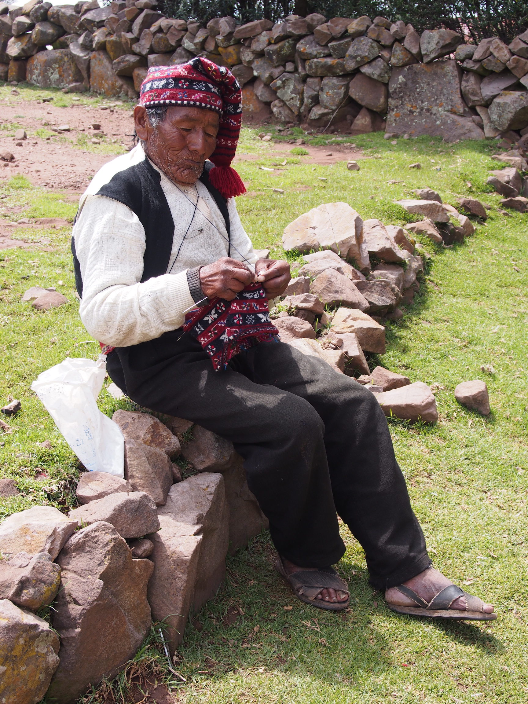
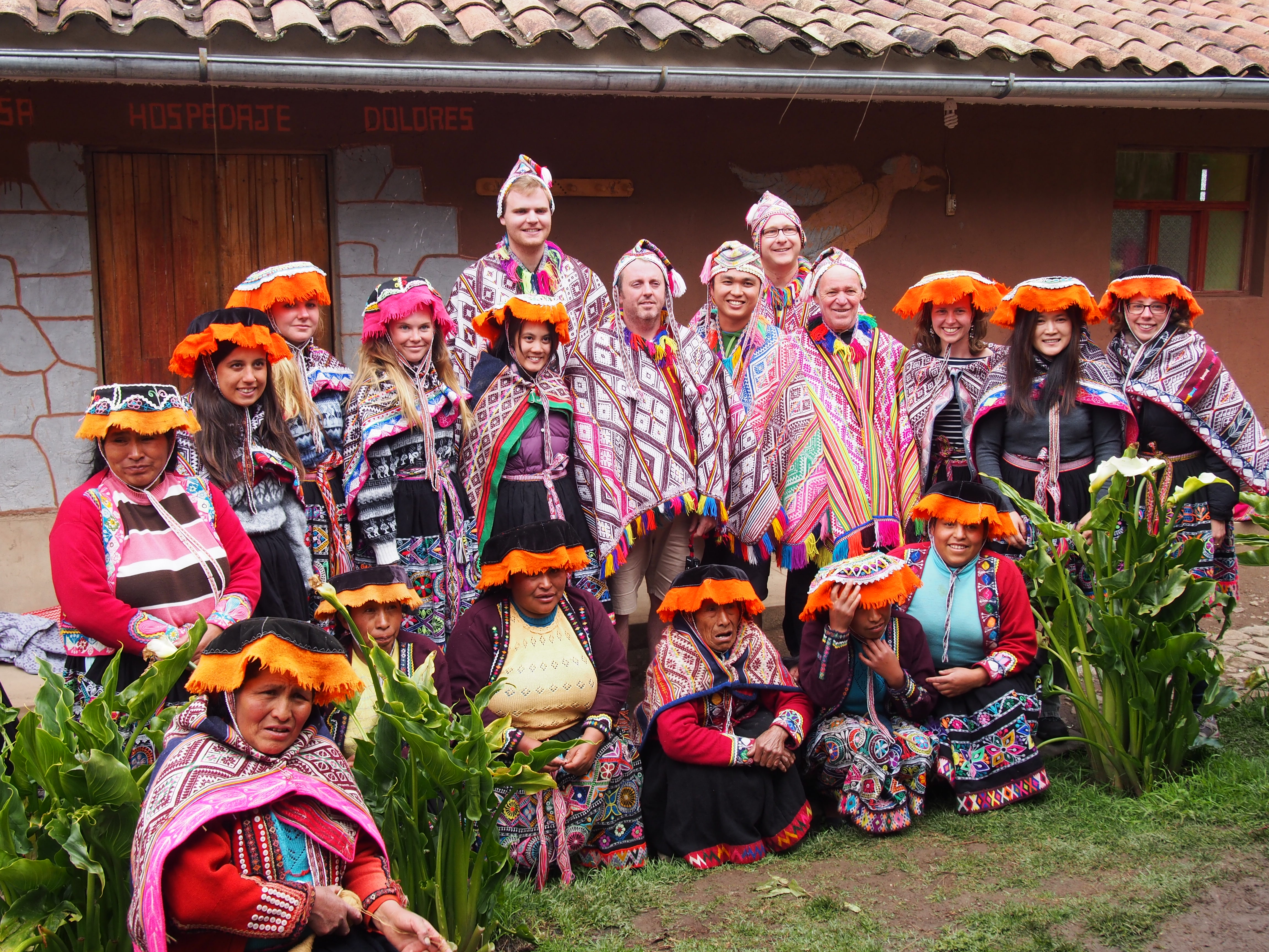
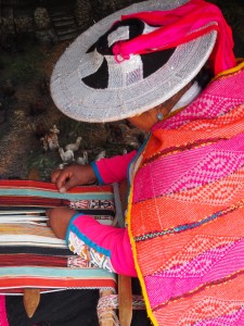
The site also gave up the opportunity to learn about how the alpaca wool is spun, dyed and used. We got to see demonstrations of all parts of the process. The weaving was particularly impressive!


Amaru

OLYMPUS DIGITAL CAMERAAmaru (the name means Snake, another important animal in the Peruvian culture) is a local village in the hills that is supported by Intrepid. We were invited into the homes of the local community to meet the women and to enjoy a home cooked traditional meal made from foods they had grown themselves. The food was absolutely delicious!

The women also dressed us up in their traditional clothing and we took photos.

They were the most welcoming and friendly people, and we were all invited back to visit again soon.

OLYMPUS DIGITAL CAMERA

Pisac

OLYMPUS DIGITAL CAMERAPisac is a town in the lowlands, where we stopped to see how the silversmith’s create their intricate pieces of jewellery. Silver is a metal found in the area. We also had the opportunity to explore the local markets for souvenirs.

The town itself was snugly nestled in the lowlands, and everywhere you looked there were mountains setting a beautiful scene.

Ollantaytambo

OLYMPUS DIGITAL CAMERAOllantaytambo was the starting point for the Inca Trail, so the visit was very brief. The city was very cute, with tiny cobbled streets and little houses, nestled amongst the mountains.

For all my Cusco & Sacred Valley photos, check out my album on Flickr.

Facebooktwitterredditpinterest

The Amazon Jungle, Puerto Maldonado, Peru

OLYMPUS DIGITAL CAMERAPuerto Maldonado is roughly a two hour flight from Lima, stopping in Cusco along the way to drop off and pick up passengers. Transport around Puerto Maldonado is quite slow as the road conditions are pretty bad.

OLYMPUS DIGITAL CAMERAWhen heading into the Amazon, you first re-pack just the necessary items into a small duffle bag before catching a boat ride up river for an hour or so to the lodge. There are many lodges each used by different companies. The lodge that Intrepid took us to was called Cayman Lodge Amazon, where we all slept in our own bungalows. We had two guides, Kristian and Jessie, who were both brilliant; they spoke English well, and were very friendly and knowledgeable about the area.

OLYMPUS DIGITAL CAMERAPuerto Maldonado is in a region of Peru called Madre de Dios, down a section of river called Rio Tambopata. While in the Amazon we enjoyed several activities, all of which centred around looking for wildlife; a river cruise, a short night cruise looking for caymans, a jungle walk, a lake boat trip and a night walk.

OLYMPUS DIGITAL CAMERAThe Amazon has so many amazing weird and wonderful creatures and which ones you see is just up to luck. Our group was lucky enough to see a number of Capybara’s (giant guinea pigs), Turtles, two different kinds of monkeys (at a great distance), a Tarantula, a tree snake, a tiny snake, and a yellow-headed Vulture during the day. When crossing a lake in the, unsuccessful, hunt for an anaconda we did a spot of fishing and caught some yellow piranhas.

OLYMPUS DIGITAL CAMERA
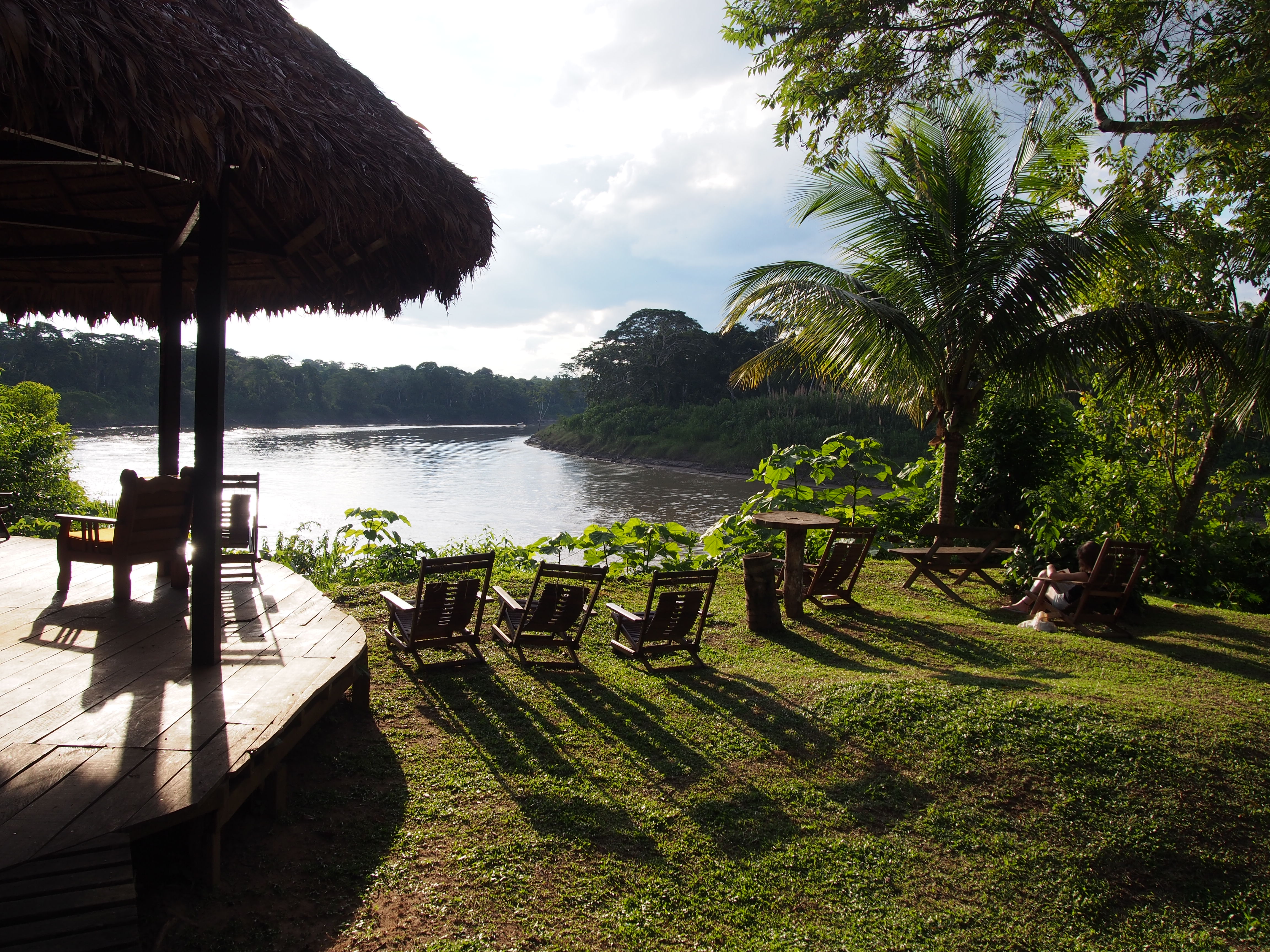
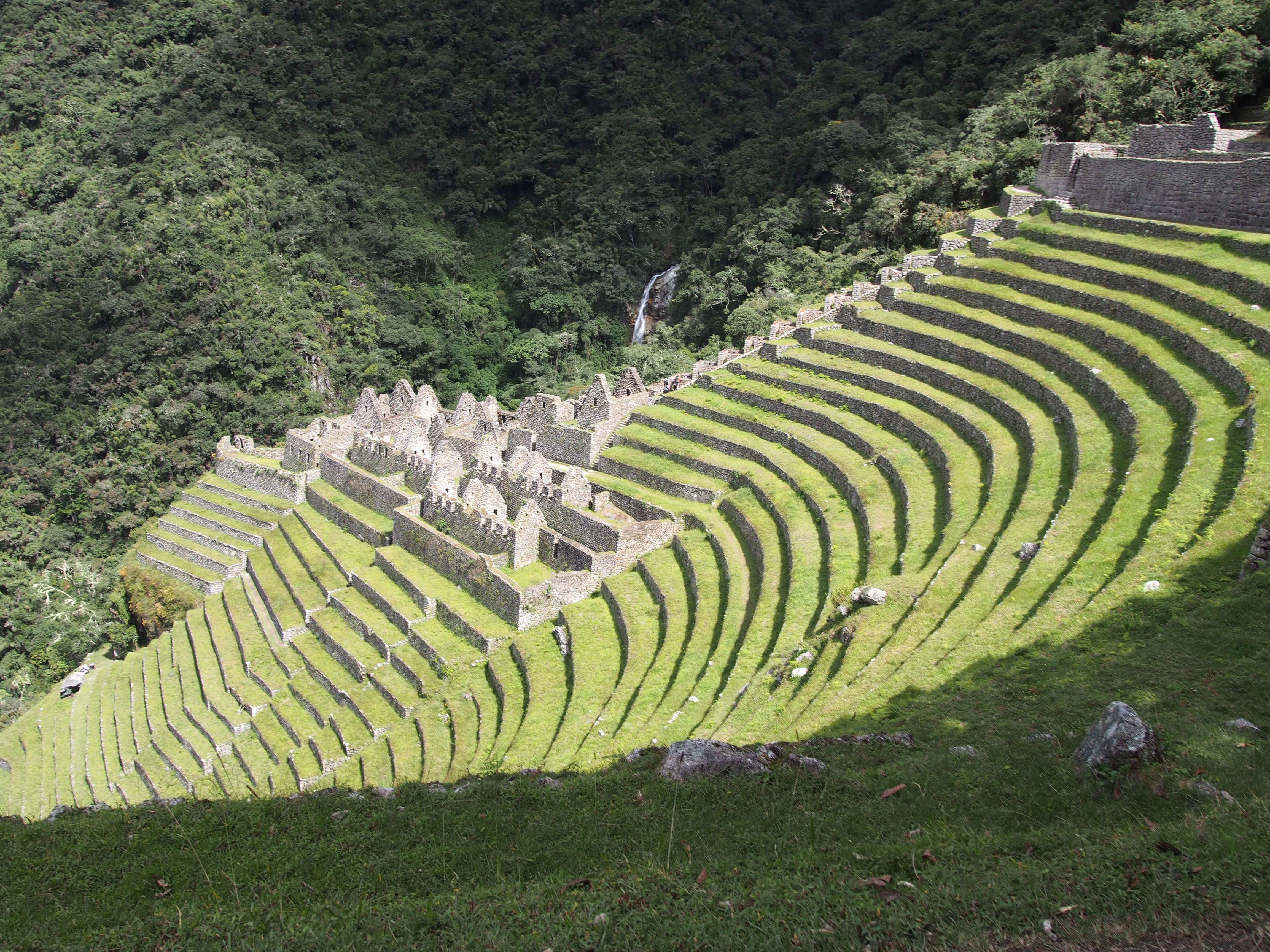
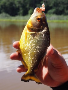
Walking through the muddy jungle, we heard wild pigs and red howler monkeys. Listening to the howler monkeys was very eerie and calming at the same time. It sounded almost like wind rushing through a tunnel. I thought it was pretty cool.

Our night walk mostly allowed us to see insects, including another tarantula, a giant spider, frogs, praying mantis’ and a wild chicken sleeping in a tree.

IMG_0339The jungle is really full of bugs, so to make the most of it you really need to wear long pants and a long-sleeved shirt despite the heat, as well as coat yourself in both sunscreen and bug spray.

The time in the jungle was pretty chilled; there isn’t much to do aside from soak up the atmosphere and keep your eyes peeled for whatever creature crosses your path.

For all my Amazon photos, check out my album on Flickr

Facebooktwitterredditpinterest

Lima, Peru

Santiago Airport

The flight to Lima went via Santiago, Chile. While this is not a particularly noteworthy event, it’s an airport worth discussing. It’s quite small, but in a sense quite chaotic. The short version is that flights don’t appear on the departure screens until the very last minute. To assist passengers find the right gate there are no information desks, airline desks or staff with knowledge of such things. Santiago airport is simply a waiting game. Not recommended for the anxious traveller.

Miraflores

OLYMPUS DIGITAL CAMERA

Lima has several suburbs, I stayed in Miraflores, which is a more affluent suburb. It is coastal, a cliff top suburb looking out over a pebble beach and the ocean. I felt that the city planning was done well as there are gorgeous wide avenues, many green parks and the city is wonderfully clean. It also feels incredibly safe and the people are friendly.

There are a few main streets worth mentioning. Avenue Jose Pardo is a main street, while it doesn’t seem to offer a lot to see or do, it feels a bit like one of the backbone roads of Miraflores.

For shopping and restaurants Malecon Balta and Avenue Larco are great. The two streets meet at Kennedy Park which is a great location, lots of people and a gorgeous park which has night stalls. It is also around the Kennedy Park area where you will find lots of restaurants.

OLYMPUS DIGITAL CAMERAIf you head all the way down Avenue Larco it ends at a cliff top shopping mall called Larco Mar. Larco Mar is very cleverly designed, open air and to make the most of the views. While they are probably more expensive, there are a number of restaurants and bars here too.

If you follow the coastline in a northerly-ish direction (I’m bad with compass directions) a walkway continues for kilometers, and passes through numerous parks. The park of Love is quite fascinating and I would say reminiscent of Gaudi’s Parc Guell in Barcelona. Lovely mosaic sculptures and walls. These cliff tops provide the most stunning backdrop for sunsets. And it is at sunset that you can go paragliding (for an obscene about of money – approx. USD$100 for 10 minutes)

OLYMPUS DIGITAL CAMERA

My day of exploring Miraflores was a Sunday, so not much was open. One place worth a mention is the ruins of Huaca Puccllana. About a ten minute walk up from Avenue Jose Pardo. Randomly in the middle of all the houses is a partially excavated site. I found the guide a little hard to hear, so I will provide my best version of what I understood.

OLYMPUS DIGITAL CAMERAAs it had previously been private property the site looked like a big pile of rubble, until it was discovered to be a buried historic site in 1981. The site was a basically a town, the area that had been restored was the temple and plazas. The pyramid at the back of the complex was used for religious purposes and was a tiered construction. A new tier was built every twenty years. For each new tier, human sacrifices were made and the bodies were buried in the tier. It was also later used as a giant cemetery.

The buildings were all constructed from bricks that were quite narrow, they were laid vertically on a slight angle, with gaps between them, the next row would be angled in the opposite direction. This is called the bookshelf technique; it is thought that this design would allow for movement without damaging the structural integrity of the buildings. It was suspected this technique was used because of the earthquakes that are known to occur in the region. I also wonder if the technique was used for insulation purposes.

Downtown Lima

OLYMPUS DIGITAL CAMERA
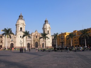
Downtown Lima is way more hectic than Miraflores and traffic is completely nuts. While I felt quite OK, I read and heard a few warnings about safety. Just make sure you are careful with your personal belonging.

The Moorish influence can be seen in the architecture in downtown Lima with many building having old timber balconies extending beyond their walls. Many of the buildings are painted bright colours and have elaborate doors and windows.

OLYMPUS DIGITAL CAMERAA few main sites in downtown Lima are Plaza San Martin, Plaza de Armas and the Monastery of San Francisco. It’s nice to wander between these sites, and they are all fairly close to each other.

Plaza san Martin and Plaza de Armas are both public squares. Plaza San Martin has a statue of San Martin and Plaza de Armas has a fountain. Bother have fantastic buildings surrounding them and it is great to just wander and take in the atmosphere and the architecture. Plaza de Armas has a large cathedral on one side and adjacent is the presidential palace (I heard there is a changing of the guard once per day, at midday).

OLYMPUS DIGITAL CAMERAThe Monastery of San Francisco is quite fascinating. The church was closed when I went, but the monastery had a guided tour throughout, including the catacombs. No photos can be taken inside, so I am unable to share, but it certainly was stunning. The old architecture, carved cedar ceilings, the art work, ornate doorways and furniture. The catacombs of course were fascinating, crypts housing hundred upon hundred of bones, I think we only saw femurs and skulls.

A piece of artwork that was particularly interesting was a Flemish painters version of the last supper. It was created with a Peruvian flair, where the main meal being shared was guinea pig and wine was being drunk from golden Inca goblets.

Food to try:

Two local dishes worth trying are Pollo a la brassa, some form of roasted chicken; and Ceviche, raw fish cured in lime juice and onion. Lomo Saltado is also quite a common Peruvian dish and is a fairly basic, but very tasty, beef stir fry.
The traditional drink is a cocktail called a Pisco Sour.

Many dishes are served with rice and chuclo. Chuclo are large white corn kernels. They don’t seem to have a whole lot of flavour.

The average cost of a meal is about 40 soles.

Where I stayed:

Prior to my tour starting I stayed at Backpacker’s Family House, only about a block from the coastline. I thought it was good value for money, good location. It was a clean hostel with friendly staff, free wifi and breakfast included.

Getting around:

Around Miraflores I found walking was easy, and the distances between places aren’t too far.
To get to downtown Lima you can catch the metropolitan (bus) or take a taxi. When you take a taxi, be sure to get the price before getting in – it should not cost more than 20 soles. (I paid between 15 and 17 soles).

OLYMPUS DIGITAL CAMERARandom Note:

In every building are ‘S’ signs, indicating where you should gather in the event of seismic activity (earthquakes).

Check out my album on Flickr, to see all my Lima photos

Facebooktwitterredditpinterest

To guide book or not to guide book?

Everyone has differing opinions on whether or not you should bother buying a guidebook. So I figured I would give you my opinion.
I’m discussing Lonely Planet mostly because they are what I personally buy.

I vote yes – buy the guidebook BUT it’s not the only thing you should use.
Let me explain.


I find that no matter where in the world you go, there is loads of research to be done about your destination, so many different websites to view and so many personal opinions to factor in. A guidebook, such as Lonely Planet, have sent someone out to that place and/or found a local to do the research and gather all the information for you. The information has been checked and double checked for accuracy and relevance; so why ignore this wealth of knowledge.

I find having an LP with me just makes it handy to look up bits and pieces of information, get some history about a place and general information. They offer fantastic suggestions for things to see, places to stay and places to eat. I like having it as a starting point, but also for looking up things as I go and for getting ideas.
Specific to the LP, I like the look of them, the way the information is organised and the comprehensive information provided.

I find though, if you use it as a bible and just stick to the information in the guidebook, you limit your experiences. Use it as a fantastic reference and great starting point, but be open to other people’s suggestions, take on board their experiences and at the end of the day make up your own mind about what to see and do.

The LP's on my iPhone right now.
The LP’s on my iPhone right now.

The other thing I would like to mention is the practicality aspect – they are bulky and weigh a tonne! If you are going to one place for a short time, then maybe that isn’t such a problem. But since I am packing for a 10 month+ adventure, the idea of multiple guidebooks in my small pack is just ridiculous. So while I love all the beautiful LP’s on my bookshelf, I have now switched to only buying eBooks. (Recently there was a deal where all eBooks were $10 each and I went nuts!!)

When you purchase the LP eBook you get access to the .mobi, .epub AND .pdf versions. So I put the .mobi files on my kindle and the .epub on my iPhone and have a backup .pdf on my laptop. This means I can cart around loads of guidebooks for all my different destinations and not worry about the bulk and weight of actual books. That’s a win-win in my opinion!

As a side note, since this morning I am a Lonely Planet Affiliate. This means if you buy an LP via a link I have shared, then I receive a small commission, which helps me continue travelling. BUT be aware, that I would not advertise something unless I personally use it, and I have been using LP’s as my guidebook of choice for at least 15 years.

Facebooktwitterredditpinterest

Turn Right at Macchu Picchu

It’s finally almost time to pack my bag and go (12 sleeps in fact). My first stop will be Peru and one of the highlights I have been eagerly awaiting is the Inca Trail hike to Macchu Picchu.

To gain some insight and to read an interesting story, I came across Turn Right at Machu Picchu by Mark Adams. I had heard it had a good historical background and was a good read.

Unfortunately I haven’t had much time to really get into it, but at chapter thirteen I’m really enjoying it. I am getting pretty excited about seeing the places mentioned in the book!
I’m sure that if I don’t get a chance to finish it before leaving, it will be great on the plane!

What books give you ‘itchy feet’?

Facebooktwitterredditpinterest